You are here: Home > Network List > TA - USArray Transportable Network (new EarthScope stations) Stations List
> Station S42A Caledonia, MO, USA > Earthquake Result Viewer
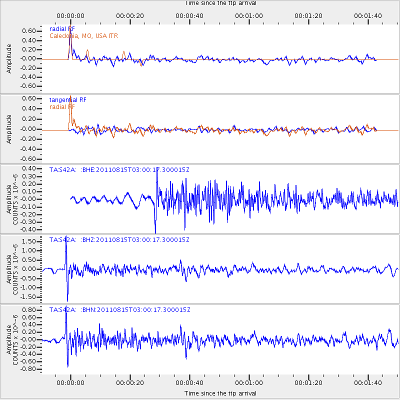
S42A Caledonia, MO, USA - Earthquake Result Viewer
*The percent match for this event was below the threshold and hence no stack was calculated.
| Earthquake location: |
Ecuador |
| Earthquake latitude/longitude: |
-1.8/-76.9 |
| Earthquake time(UTC): |
2011/08/15 (227) 02:53:18 GMT |
| Earthquake Depth: |
177 km |
| Earthquake Magnitude: |
5.7 MB, 5.7 MW, 5.7 MW |
| Earthquake Catalog/Contributor: |
WHDF/NEIC |
|
| Network: |
TA USArray Transportable Network (new EarthScope stations) |
| Station: |
S42A Caledonia, MO, USA |
| Lat/Lon: |
37.77 N/90.79 W |
| Elevation: |
315 m |
|
| Distance: |
41.4 deg |
| Az: |
343.297 deg |
| Baz: |
158.747 deg |
| Ray Param: |
$rayparam |
*The percent match for this event was below the threshold and hence was not used in the summary stack. |
|
| Radial Match: |
76.51301 % |
| Radial Bump: |
400 |
| Transverse Match: |
51.16103 % |
| Transverse Bump: |
400 |
| SOD ConfigId: |
410809 |
| Insert Time: |
2012-01-06 06:00:28.758 +0000 |
| GWidth: |
2.5 |
| Max Bumps: |
400 |
| Tol: |
0.001 |
|
Signal To Noise
| Channel | StoN | STA | LTA |
| TA:S42A: :BHZ:20110815T03:00:17.300015Z | 5.1693683 | 3.9782773E-7 | 7.695867E-8 |
| TA:S42A: :BHN:20110815T03:00:17.300015Z | 5.4037714 | 2.306645E-7 | 4.2685837E-8 |
| TA:S42A: :BHE:20110815T03:00:17.300015Z | 3.1916215 | 1.3162165E-7 | 4.1239744E-8 |
| Arrivals |
| Ps | |
| PpPs | |
| PsPs/PpSs | |


