You are here: Home > Network List > CI - Caltech Regional Seismic Network Stations List
> Station MPP McPhearson Peak > Earthquake Result Viewer
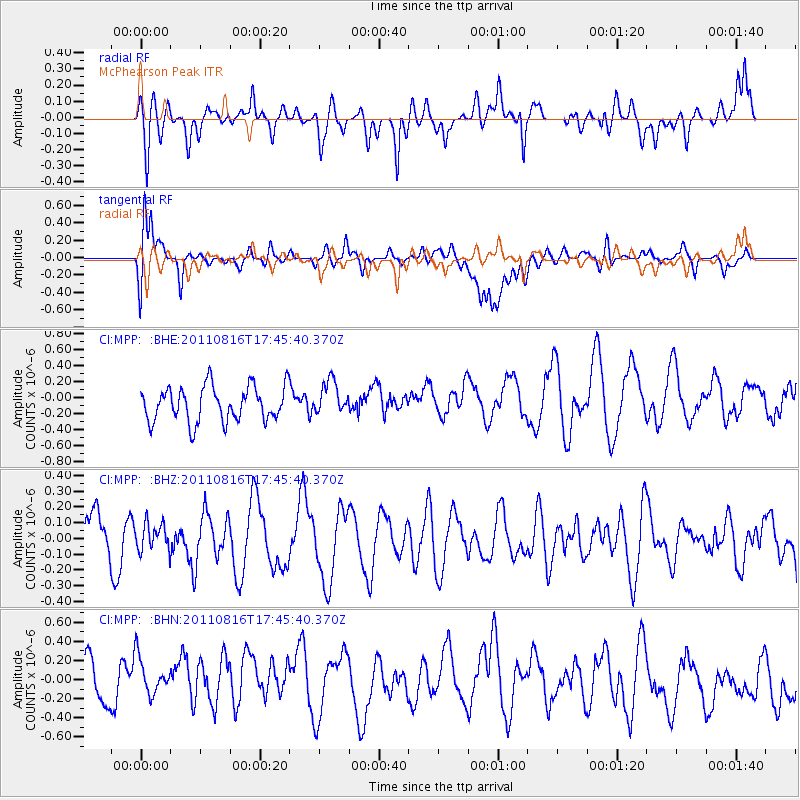
MPP McPhearson Peak - Earthquake Result Viewer
*The percent match for this event was below the threshold and hence no stack was calculated.
| Earthquake location: |
Eastern New Guinea Reg., P.N.G. |
| Earthquake latitude/longitude: |
-5.6/147.1 |
| Earthquake time(UTC): |
2011/08/16 (228) 17:33:07 GMT |
| Earthquake Depth: |
186 km |
| Earthquake Magnitude: |
5.6 MW, 5.2 MB, 5.6 MW |
| Earthquake Catalog/Contributor: |
WHDF/NEIC |
|
| Network: |
CI Caltech Regional Seismic Network |
| Station: |
MPP McPhearson Peak |
| Lat/Lon: |
34.89 N/119.81 W |
| Elevation: |
1739 m |
|
| Distance: |
95.6 deg |
| Az: |
55.578 deg |
| Baz: |
267.178 deg |
| Ray Param: |
$rayparam |
*The percent match for this event was below the threshold and hence was not used in the summary stack. |
|
| Radial Match: |
62.717377 % |
| Radial Bump: |
400 |
| Transverse Match: |
65.44064 % |
| Transverse Bump: |
400 |
| SOD ConfigId: |
410809 |
| Insert Time: |
2012-01-06 06:18:15.302 +0000 |
| GWidth: |
2.5 |
| Max Bumps: |
400 |
| Tol: |
0.001 |
|
Signal To Noise
| Channel | StoN | STA | LTA |
| CI:MPP: :BHZ:20110816T17:45:40.370Z | 0.39772493 | 8.506602E-8 | 2.1388153E-7 |
| CI:MPP: :BHN:20110816T17:45:40.370Z | 1.0715501 | 2.7444685E-7 | 2.5612133E-7 |
| CI:MPP: :BHE:20110816T17:45:40.370Z | 0.96420974 | 2.0854424E-7 | 2.1628514E-7 |
| Arrivals |
| Ps | |
| PpPs | |
| PsPs/PpSs | |


