You are here: Home > Network List > G - GEOSCOPE Stations List
> Station RER Riviere de l'Est, La Reunion (Indian Ocean) > Earthquake Result Viewer
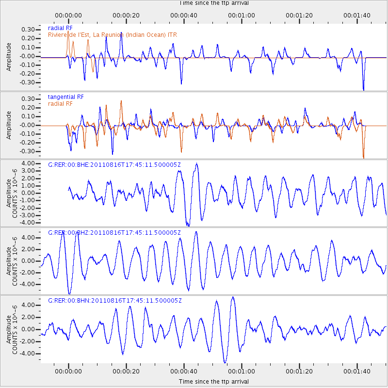
RER Riviere de l'Est, La Reunion (Indian Ocean) - Earthquake Result Viewer
*The percent match for this event was below the threshold and hence no stack was calculated.
| Earthquake location: |
Eastern New Guinea Reg., P.N.G. |
| Earthquake latitude/longitude: |
-5.6/147.1 |
| Earthquake time(UTC): |
2011/08/16 (228) 17:33:07 GMT |
| Earthquake Depth: |
186 km |
| Earthquake Magnitude: |
5.6 MW, 5.2 MB, 5.6 MW |
| Earthquake Catalog/Contributor: |
WHDF/NEIC |
|
| Network: |
G GEOSCOPE |
| Station: |
RER Riviere de l'Est, La Reunion (Indian Ocean) |
| Lat/Lon: |
21.16 S/55.75 E |
| Elevation: |
834 m |
|
| Distance: |
89.3 deg |
| Az: |
248.936 deg |
| Baz: |
95.653 deg |
| Ray Param: |
$rayparam |
*The percent match for this event was below the threshold and hence was not used in the summary stack. |
|
| Radial Match: |
71.555954 % |
| Radial Bump: |
400 |
| Transverse Match: |
73.10489 % |
| Transverse Bump: |
400 |
| SOD ConfigId: |
410809 |
| Insert Time: |
2012-01-06 06:18:26.823 +0000 |
| GWidth: |
2.5 |
| Max Bumps: |
400 |
| Tol: |
0.001 |
|
Signal To Noise
| Channel | StoN | STA | LTA |
| G:RER:00:BHZ:20110816T17:45:11.500005Z | 2.3586955 | 3.5523954E-6 | 1.5060848E-6 |
| G:RER:00:BHN:20110816T17:45:11.500005Z | 0.96822506 | 1.0724063E-6 | 1.1076003E-6 |
| G:RER:00:BHE:20110816T17:45:11.500005Z | 0.70345 | 5.468857E-7 | 7.774336E-7 |
| Arrivals |
| Ps | |
| PpPs | |
| PsPs/PpSs | |


