You are here: Home > Network List > G - GEOSCOPE Stations List
> Station INU Inuyama, Japan > Earthquake Result Viewer
INU Inuyama, Japan - Earthquake Result Viewer
*The percent match for this event was below the threshold and hence no stack was calculated.
| Earthquake location: |
Eastern New Guinea Reg., P.N.G. |
| Earthquake latitude/longitude: |
-5.6/147.1 |
| Earthquake time(UTC): |
2011/08/16 (228) 17:33:07 GMT |
| Earthquake Depth: |
186 km |
| Earthquake Magnitude: |
5.6 MW, 5.2 MB, 5.6 MW |
| Earthquake Catalog/Contributor: |
WHDF/NEIC |
|
| Network: |
G GEOSCOPE |
| Station: |
INU Inuyama, Japan |
| Lat/Lon: |
35.35 N/137.03 E |
| Elevation: |
132 m |
|
| Distance: |
41.8 deg |
| Az: |
347.558 deg |
| Baz: |
164.792 deg |
| Ray Param: |
$rayparam |
*The percent match for this event was below the threshold and hence was not used in the summary stack. |
|
| Radial Match: |
49.684532 % |
| Radial Bump: |
400 |
| Transverse Match: |
60.420734 % |
| Transverse Bump: |
400 |
| SOD ConfigId: |
410809 |
| Insert Time: |
2012-01-06 06:18:28.232 +0000 |
| GWidth: |
2.5 |
| Max Bumps: |
400 |
| Tol: |
0.001 |
|
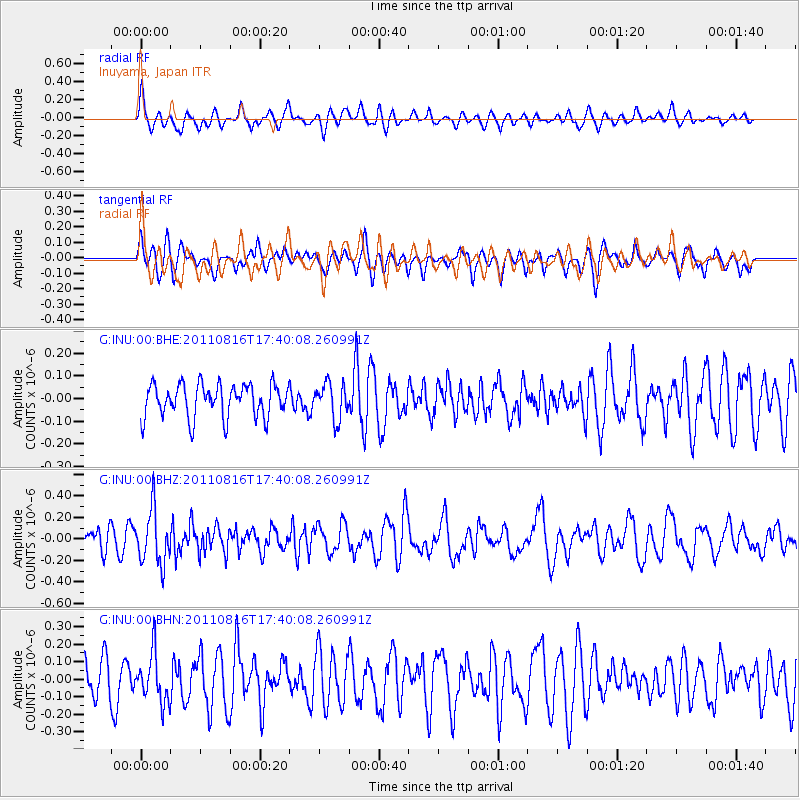
Signal To Noise
| Channel | StoN | STA | LTA |
| G:INU:00:BHZ:20110816T17:40:08.260991Z | 3.136105 | 2.4983478E-7 | 7.966404E-8 |
| G:INU:00:BHN:20110816T17:40:08.260991Z | 1.2788936 | 1.412687E-7 | 1.1046165E-7 |
| G:INU:00:BHE:20110816T17:40:08.260991Z | 1.069187 | 7.822069E-8 | 7.315903E-8 |
| Arrivals |
| Ps | |
| PpPs | |
| PsPs/PpSs | |


