You are here: Home > Network List > UW - Pacific Northwest Regional Seismic Network Stations List
> Station MRBL Marblemount, WA, USA > Earthquake Result Viewer
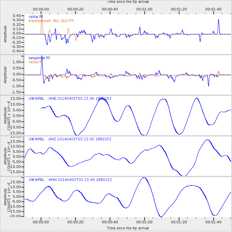
MRBL Marblemount, WA, USA - Earthquake Result Viewer
*The percent match for this event was below the threshold and hence no stack was calculated.
| Earthquake location: |
Near Coast Of Northern Chile |
| Earthquake latitude/longitude: |
-20.6/-70.7 |
| Earthquake time(UTC): |
2014/04/03 (093) 03:11:14 GMT |
| Earthquake Depth: |
10 km |
| Earthquake Magnitude: |
5.8 MB |
| Earthquake Catalog/Contributor: |
NEIC PDE/NEIC COMCAT |
|
| Network: |
UW Pacific Northwest Regional Seismic Network |
| Station: |
MRBL Marblemount, WA, USA |
| Lat/Lon: |
48.52 N/121.48 W |
| Elevation: |
75 m |
|
| Distance: |
82.4 deg |
| Az: |
328.705 deg |
| Baz: |
132.966 deg |
| Ray Param: |
$rayparam |
*The percent match for this event was below the threshold and hence was not used in the summary stack. |
|
| Radial Match: |
75.76884 % |
| Radial Bump: |
316 |
| Transverse Match: |
63.80989 % |
| Transverse Bump: |
400 |
| SOD ConfigId: |
3390531 |
| Insert Time: |
2019-04-11 02:29:44.735 +0000 |
| GWidth: |
2.5 |
| Max Bumps: |
400 |
| Tol: |
0.001 |
|
Signal To Noise
| Channel | StoN | STA | LTA |
| UW:MRBL: :HHZ:20140403T03:23:06.188015Z | 1.4792949 | 7.809427E-6 | 5.2791547E-6 |
| UW:MRBL: :HHN:20140403T03:23:06.188015Z | 1.3780823 | 9.917151E-6 | 7.196342E-6 |
| UW:MRBL: :HHE:20140403T03:23:06.188015Z | 1.2545925 | 1.0565341E-5 | 8.4213325E-6 |
| Arrivals |
| Ps | |
| PpPs | |
| PsPs/PpSs | |


