HUMO Hull Mountain, OR - Earthquake Result Viewer
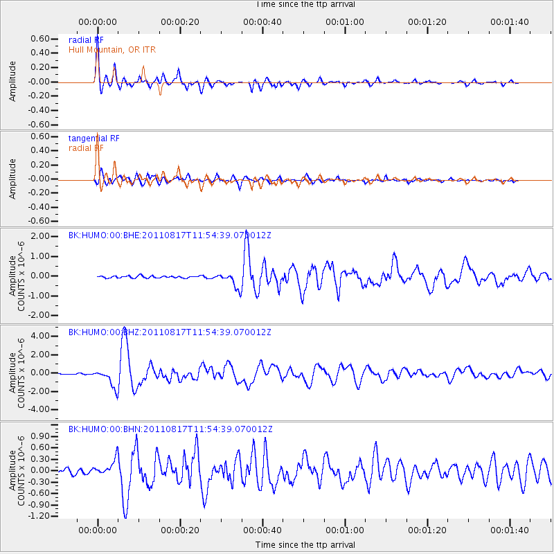
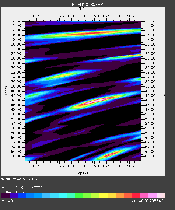
Earthquake location: Off East Coast Of Honshu, Japan
Earthquake latitude/longitude: 36.8/143.8
Earthquake time(UTC): 2011/08/17 (229) 11:44:08 GMT
Earthquake Depth: 9.0 km
Earthquake Magnitude: 6.1 MB, 5.8 MS, 6.2 MW, 6.1 MW
Earthquake Catalog/Contributor: WHDF/NEIC
Network: BK Berkeley Digital Seismograph Network
Station: HUMO Hull Mountain, OR
Lat/Lon: 42.61 N/122.96 W
Elevation: 555 m
Distance: 68.4 deg
Az: 52.442 deg
Baz: 300.429 deg
Ray Param: 0.056330565
Estimated Moho Depth: 44.0 km
Estimated Crust Vp/Vs: 1.91
Assumed Crust Vp: 6.522 km/s
Estimated Crust Vs: 3.419 km/s
Estimated Crust Poisson's Ratio: 0.31
Radial Match: 95.14914 %
Radial Bump: 400
Transverse Match: 88.97897 %
Transverse Bump: 400
SOD ConfigId: 410809
Insert Time: 2012-01-06 06:28:15.679 +0000
GWidth: 2.5
Max Bumps: 400
Tol: 0.001

Signal To Noise

ChannelStoNSTALTA
BK:HUMO:00:BHZ:20110817T11:54:39.070012Z11.4987971.0326246E-68.980284E-8
BK:HUMO:00:BHN:20110817T11:54:39.070012Z3.7954982.1921446E-75.775644E-8
BK:HUMO:00:BHE:20110817T11:54:39.070012Z7.9059814.138814E-75.2350412E-8
Arrivals
Ps6.4 SECOND
PpPs19 SECOND
PsPs/PpSs25 SECOND