MPM Manuel Prospect Mine, California, USA - Earthquake Result Viewer
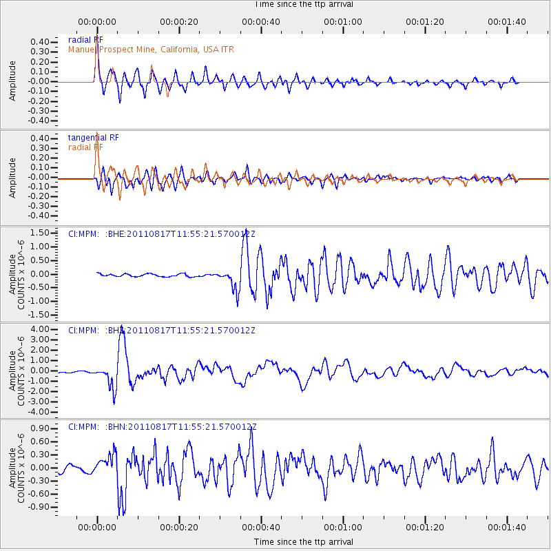
Earthquake location: Off East Coast Of Honshu, Japan
Earthquake latitude/longitude: 36.8/143.8
Earthquake time(UTC): 2011/08/17 (229) 11:44:08 GMT
Earthquake Depth: 9.0 km
Earthquake Magnitude: 6.1 MB, 5.8 MS, 6.2 MW, 6.1 MW
Earthquake Catalog/Contributor: WHDF/NEIC
Network: CI Caltech Regional Seismic Network
Station: MPM Manuel Prospect Mine, California, USA
Lat/Lon: 36.06 N/117.49 W
Elevation: 185 m
Distance: 75.5 deg
Az: 55.815 deg
Baz: 304.935 deg
Ray Param: 0.05162827
Estimated Moho Depth: 31.75 km
Estimated Crust Vp/Vs: 1.79
Assumed Crust Vp: 6.279 km/s
Estimated Crust Vs: 3.517 km/s
Estimated Crust Poisson's Ratio: 0.27
Radial Match: 93.91679 %
Radial Bump: 400
Transverse Match: 86.28467 %
Transverse Bump: 400
SOD ConfigId: 410809
Insert Time: 2012-01-06 06:30:58.253 +0000
GWidth: 2.5
Max Bumps: 400
Tol: 0.001

Signal To Noise

ChannelStoNSTALTA
CI:MPM: :BHZ:20110817T11:55:21.570012Z16.8025041.1320607E-66.737452E-8
CI:MPM: :BHN:20110817T11:55:21.570012Z3.59467082.5201336E-77.01075E-8
CI:MPM: :BHE:20110817T11:55:21.570012Z7.89431673.993323E-75.0584784E-8
Arrivals
Ps4.1 SECOND
PpPs14 SECOND
PsPs/PpSs18 SECOND