DRV Dumont d'Urville, Terre Adelie (Antartica) - Earthquake Result Viewer
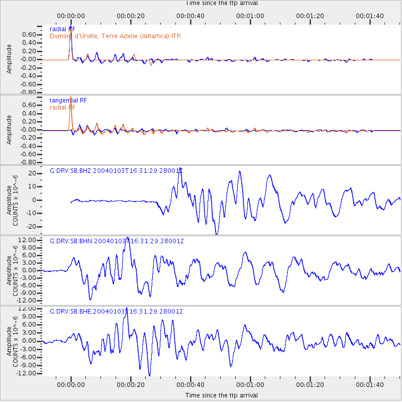
Earthquake location: Southeast Of Loyalty Islands
Earthquake latitude/longitude: -22.3/169.7
Earthquake time(UTC): 2004/01/03 (003) 16:23:21 GMT
Earthquake Depth: 22 km
Earthquake Magnitude: 6.4 MB, 7.1 MS, 7.1 MW, 6.8 MW
Earthquake Catalog/Contributor: WHDF/NEIC
Network: G GEOSCOPE
Station: DRV Dumont d'Urville, Terre Adelie (Antartica)
Lat/Lon: 66.67 S/140.01 E
Elevation: 40 m
Distance: 48.2 deg
Az: 195.329 deg
Baz: 37.938 deg
Ray Param: 0.06945592
Estimated Moho Depth: 22.75 km
Estimated Crust Vp/Vs: 1.62
Assumed Crust Vp: 6.39 km/s
Estimated Crust Vs: 3.938 km/s
Estimated Crust Poisson's Ratio: 0.19
Radial Match: 98.603294 %
Radial Bump: 265
Transverse Match: 93.700516 %
Transverse Bump: 400
SOD ConfigId: 2459
Insert Time: 2010-02-26 22:04:23.690 +0000
GWidth: 2.5
Max Bumps: 400
Tol: 0.001

Signal To Noise

ChannelStoNSTALTA
G:DRV:SB:BHN:20040103T16:31:29.28001Z12.0757013.504424E-62.902046E-7
G:DRV:SB:BHE:20040103T16:31:29.28001Z6.52279042.1759583E-63.3359316E-7
G:DRV:SB:BHZ:20040103T16:31:29.28001Z18.5158626.7605024E-63.6511952E-7
Arrivals
Ps2.4 SECOND
PpPs8.7 SECOND
PsPs/PpSs11 SECOND