IDI Anogia, Greece - Earthquake Result Viewer
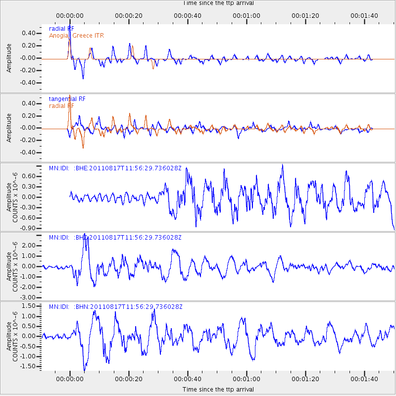
Earthquake location: Off East Coast Of Honshu, Japan
Earthquake latitude/longitude: 36.8/143.8
Earthquake time(UTC): 2011/08/17 (229) 11:44:08 GMT
Earthquake Depth: 9.0 km
Earthquake Magnitude: 6.1 MB, 5.8 MS, 6.2 MW, 6.1 MW
Earthquake Catalog/Contributor: WHDF/NEIC
Network: MN MEDNET Project
Station: IDI Anogia, Greece
Lat/Lon: 35.29 N/24.89 E
Elevation: 750 m
Distance: 88.5 deg
Az: 314.228 deg
Baz: 44.699 deg
Ray Param: 0.042511217
Estimated Moho Depth: 39.25 km
Estimated Crust Vp/Vs: 1.95
Assumed Crust Vp: 5.627 km/s
Estimated Crust Vs: 2.893 km/s
Estimated Crust Poisson's Ratio: 0.32
Radial Match: 86.99069 %
Radial Bump: 400
Transverse Match: 90.42126 %
Transverse Bump: 400
SOD ConfigId: 410809
Insert Time: 2012-01-06 06:40:02.854 +0000
GWidth: 2.5
Max Bumps: 400
Tol: 0.001

Signal To Noise

ChannelStoNSTALTA
MN:IDI: :BHZ:20110817T11:56:29.736028Z9.5601711.0044201E-61.05062995E-7
MN:IDI: :BHN:20110817T11:56:29.736028Z5.84045654.9241333E-78.431076E-8
MN:IDI: :BHE:20110817T11:56:29.736028Z3.25579072.638796E-78.1049315E-8
Arrivals
Ps6.7 SECOND
PpPs20 SECOND
PsPs/PpSs27 SECOND