T25A Trinidad, CO, USA - Earthquake Result Viewer
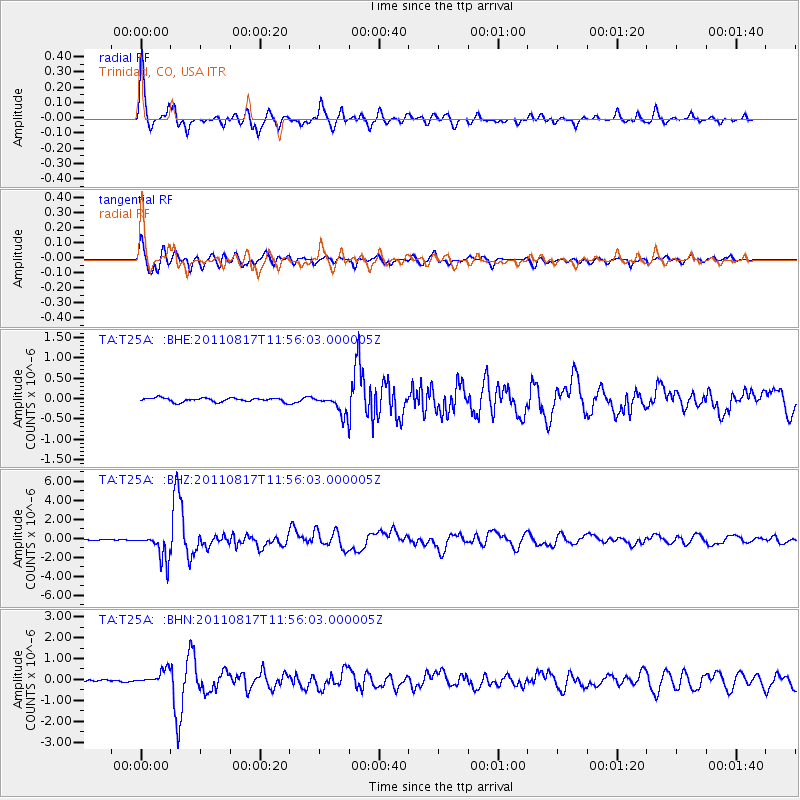
Earthquake location: Off East Coast Of Honshu, Japan
Earthquake latitude/longitude: 36.8/143.8
Earthquake time(UTC): 2011/08/17 (229) 11:44:08 GMT
Earthquake Depth: 9.0 km
Earthquake Magnitude: 6.1 MB, 5.8 MS, 6.2 MW, 6.1 MW
Earthquake Catalog/Contributor: WHDF/NEIC
Network: TA USArray Transportable Network (new EarthScope stations)
Station: T25A Trinidad, CO, USA
Lat/Lon: 37.14 N/104.41 W
Elevation: 2017 m
Distance: 83.1 deg
Az: 48.353 deg
Baz: 311.332 deg
Ray Param: 0.046413876
Estimated Moho Depth: 41.0 km
Estimated Crust Vp/Vs: 1.82
Assumed Crust Vp: 6.316 km/s
Estimated Crust Vs: 3.47 km/s
Estimated Crust Poisson's Ratio: 0.28
Radial Match: 94.71418 %
Radial Bump: 400
Transverse Match: 94.10077 %
Transverse Bump: 400
SOD ConfigId: 410809
Insert Time: 2012-01-06 06:44:21.215 +0000
GWidth: 2.5
Max Bumps: 400
Tol: 0.001

Signal To Noise

ChannelStoNSTALTA
TA:T25A: :BHZ:20110817T11:56:03.000005Z24.3853281.4461075E-65.930236E-8
TA:T25A: :BHN:20110817T11:56:03.000005Z5.9321643.3742893E-75.688125E-8
TA:T25A: :BHE:20110817T11:56:03.000005Z5.08635762.459338E-74.8351655E-8
Arrivals
Ps5.5 SECOND
PpPs18 SECOND
PsPs/PpSs23 SECOND