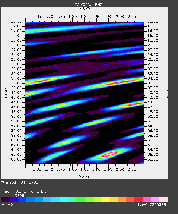
K04D Chiloquin, OR, USA - Earthquake Result Viewer
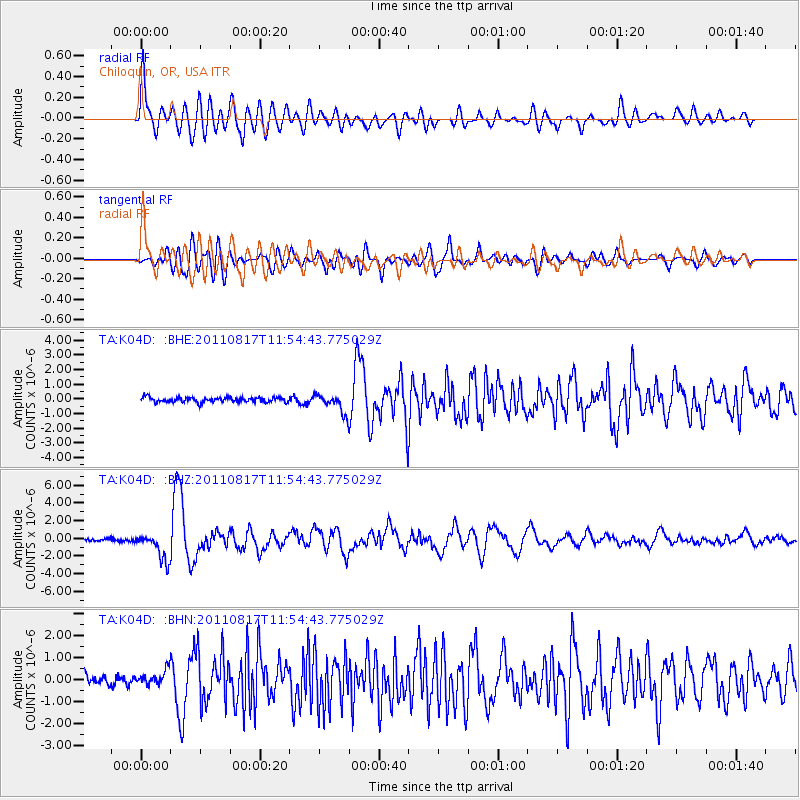
Earthquake location: Off East Coast Of Honshu, Japan
Earthquake latitude/longitude: 36.8/143.8
Earthquake time(UTC): 2011/08/17 (229) 11:44:08 GMT
Earthquake Depth: 9.0 km
Earthquake Magnitude: 6.1 MB, 5.8 MS, 6.2 MW, 6.1 MW
Earthquake Catalog/Contributor: WHDF/NEIC
Network: TA USArray Transportable Network (new EarthScope stations)
Station: K04D Chiloquin, OR, USA
Lat/Lon: 42.62 N/121.75 W
Elevation: 1315 m
Distance: 69.2 deg
Az: 51.939 deg
Baz: 301.058 deg
Ray Param: 0.055836983
Estimated Moho Depth: 65.75 km
Estimated Crust Vp/Vs: 1.95
Assumed Crust Vp: 6.597 km/s
Estimated Crust Vs: 3.379 km/s
Estimated Crust Poisson's Ratio: 0.32
Radial Match: 84.45785 %
Radial Bump: 400
Transverse Match: 78.90509 %
Transverse Bump: 400
SOD ConfigId: 410809
Insert Time: 2012-01-06 06:48:56.304 +0000
GWidth: 2.5
Max Bumps: 400
Tol: 0.001

Signal To Noise

ChannelStoNSTALTA
TA:K04D: :BHZ:20110817T11:54:43.775029Z12.2876251.5615925E-61.270866E-7
TA:K04D: :BHN:20110817T11:54:43.775029Z1.54766693.4260123E-72.2136625E-7
TA:K04D: :BHE:20110817T11:54:43.775029Z3.7291256.310562E-71.6922365E-7
Arrivals
Ps9.8 SECOND
PpPs28 SECOND
PsPs/PpSs38 SECOND