
J05D Fort Rock, OR, USA - Earthquake Result Viewer
| ||||||||||||||||||
| ||||||||||||||||||
| ||||||||||||||||||
|
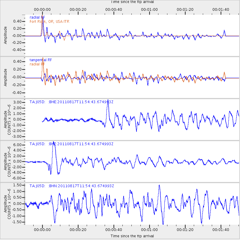
Signal To Noise
| Channel | StoN | STA | LTA |
| TA:J05D: :BHZ:20110817T11:54:43.674993Z | 17.767403 | 1.4652821E-6 | 8.247025E-8 |
| TA:J05D: :BHN:20110817T11:54:43.674993Z | 1.7894348 | 1.7728175E-7 | 9.9071364E-8 |
| TA:J05D: :BHE:20110817T11:54:43.674993Z | 2.639351 | 3.7335082E-7 | 1.4145554E-7 |
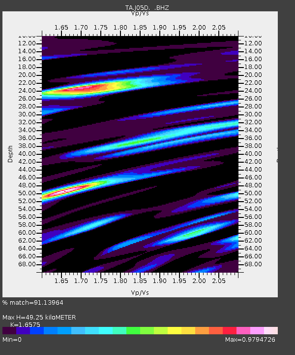
| Arrivals | |
| Ps | 5.1 SECOND |
| PpPs | 19 SECOND |
| PsPs/PpSs | 24 SECOND |

