
DRV Dumont d'Urville, Terre Adelie (Antartica) - Earthquake Result Viewer
| ||||||||||||||||||
| ||||||||||||||||||
| ||||||||||||||||||
|
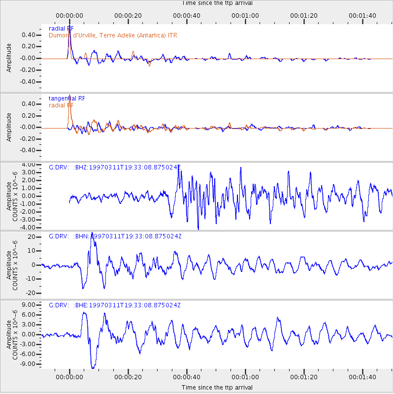
Signal To Noise
| Channel | StoN | STA | LTA |
| G:DRV: :BHN:19970311T19:33:08.875024Z | 8.7435875 | 5.5793553E-6 | 6.381083E-7 |
| G:DRV: :BHE:19970311T19:33:08.875024Z | 6.026762 | 2.246456E-6 | 3.7274677E-7 |
| G:DRV: :BHZ:19970311T19:33:08.875024Z | 2.6509123 | 8.5603915E-7 | 3.2292246E-7 |
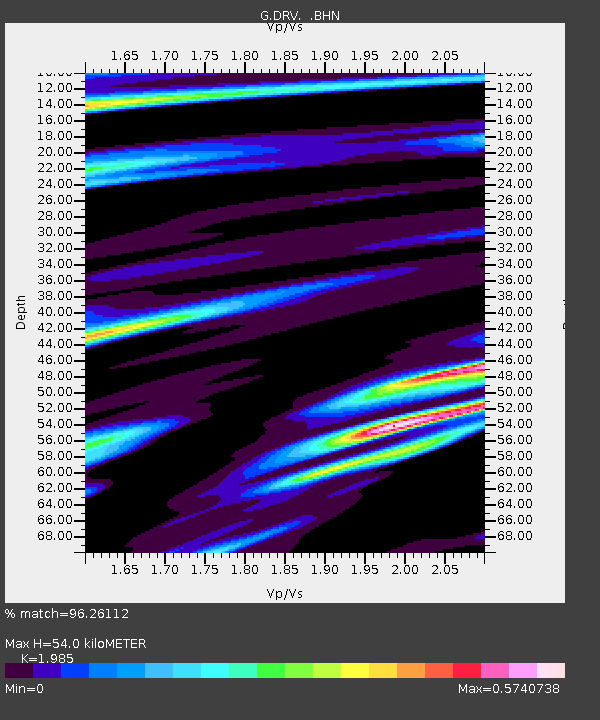
| Arrivals | |
| Ps | 8.6 SECOND |
| PpPs | 25 SECOND |
| PsPs/PpSs | 33 SECOND |

