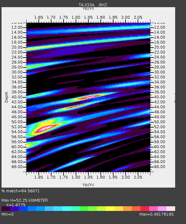
X33A Lawton, OK, USA - Earthquake Result Viewer
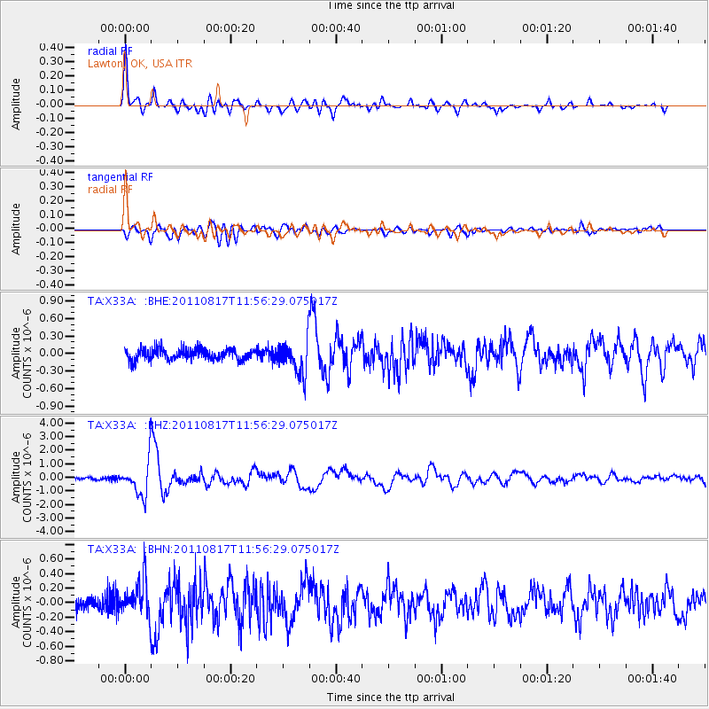
Earthquake location: Off East Coast Of Honshu, Japan
Earthquake latitude/longitude: 36.8/143.8
Earthquake time(UTC): 2011/08/17 (229) 11:44:08 GMT
Earthquake Depth: 9.0 km
Earthquake Magnitude: 6.1 MB, 5.8 MS, 6.2 MW, 6.1 MW
Earthquake Catalog/Contributor: WHDF/NEIC
Network: TA USArray Transportable Network (new EarthScope stations)
Station: X33A Lawton, OK, USA
Lat/Lon: 34.54 N/98.50 W
Elevation: 346 m
Distance: 88.4 deg
Az: 46.968 deg
Baz: 314.678 deg
Ray Param: 0.0426167
Estimated Moho Depth: 52.25 km
Estimated Crust Vp/Vs: 1.68
Assumed Crust Vp: 6.315 km/s
Estimated Crust Vs: 3.765 km/s
Estimated Crust Poisson's Ratio: 0.22
Radial Match: 94.56871 %
Radial Bump: 400
Transverse Match: 78.88568 %
Transverse Bump: 400
SOD ConfigId: 410809
Insert Time: 2012-01-06 06:50:02.630 +0000
GWidth: 2.5
Max Bumps: 400
Tol: 0.001

Signal To Noise

ChannelStoNSTALTA
TA:X33A: :BHZ:20110817T11:56:29.075017Z12.508371.2670534E-61.0129644E-7
TA:X33A: :BHN:20110817T11:56:29.075017Z1.99430422.4866438E-71.2468728E-7
TA:X33A: :BHE:20110817T11:56:29.075017Z3.25158863.02961E-79.3173234E-8
Arrivals
Ps5.7 SECOND
PpPs22 SECOND
PsPs/PpSs27 SECOND