338A Crockett, TX, USA - Earthquake Result Viewer
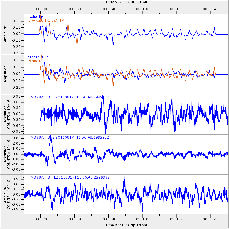
Earthquake location: Off East Coast Of Honshu, Japan
Earthquake latitude/longitude: 36.8/143.8
Earthquake time(UTC): 2011/08/17 (229) 11:44:08 GMT
Earthquake Depth: 9.0 km
Earthquake Magnitude: 6.1 MB, 5.8 MS, 6.2 MW, 6.1 MW
Earthquake Catalog/Contributor: WHDF/NEIC
Network: TA USArray Transportable Network (new EarthScope stations)
Station: 338A Crockett, TX, USA
Lat/Lon: 31.36 N/95.31 W
Elevation: 137 m
Distance: 92.5 deg
Az: 47.277 deg
Baz: 316.403 deg
Ray Param: 0.041437864
Estimated Moho Depth: 29.5 km
Estimated Crust Vp/Vs: 2.05
Assumed Crust Vp: 5.738 km/s
Estimated Crust Vs: 2.803 km/s
Estimated Crust Poisson's Ratio: 0.34
Radial Match: 80.97946 %
Radial Bump: 400
Transverse Match: 73.52774 %
Transverse Bump: 400
SOD ConfigId: 410809
Insert Time: 2012-01-06 06:55:08.781 +0000
GWidth: 2.5
Max Bumps: 400
Tol: 0.001

Signal To Noise

ChannelStoNSTALTA
TA:338A: :BHZ:20110817T11:56:48.299993Z3.60153688.7835184E-72.438825E-7
TA:338A: :BHN:20110817T11:56:48.299993Z1.71880642.5596245E-71.4891872E-7
TA:338A: :BHE:20110817T11:56:48.299993Z0.79553981.6843988E-72.117303E-7
Arrivals
Ps5.5 SECOND
PpPs15 SECOND
PsPs/PpSs21 SECOND