W36A Wetumka, OK, USA - Earthquake Result Viewer
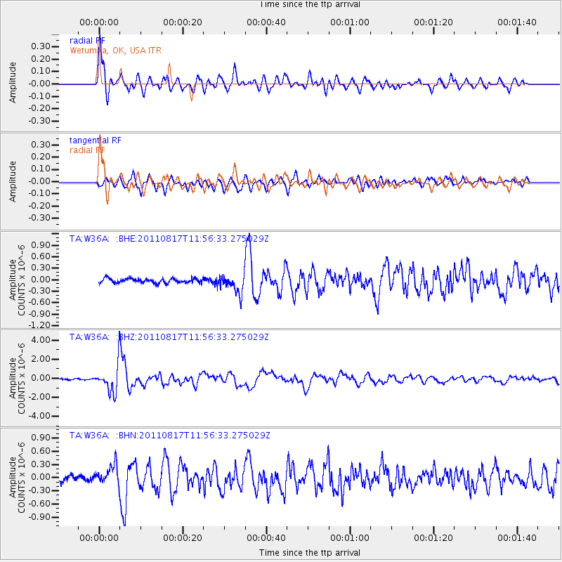
Earthquake location: Off East Coast Of Honshu, Japan
Earthquake latitude/longitude: 36.8/143.8
Earthquake time(UTC): 2011/08/17 (229) 11:44:08 GMT
Earthquake Depth: 9.0 km
Earthquake Magnitude: 6.1 MB, 5.8 MS, 6.2 MW, 6.1 MW
Earthquake Catalog/Contributor: WHDF/NEIC
Network: TA USArray Transportable Network (new EarthScope stations)
Station: W36A Wetumka, OK, USA
Lat/Lon: 35.14 N/96.23 W
Elevation: 251 m
Distance: 89.3 deg
Az: 45.218 deg
Baz: 315.936 deg
Ray Param: 0.041958727
Estimated Moho Depth: 65.75 km
Estimated Crust Vp/Vs: 1.89
Assumed Crust Vp: 6.426 km/s
Estimated Crust Vs: 3.391 km/s
Estimated Crust Poisson's Ratio: 0.31
Radial Match: 94.9718 %
Radial Bump: 400
Transverse Match: 90.341225 %
Transverse Bump: 400
SOD ConfigId: 410809
Insert Time: 2012-01-06 06:57:05.824 +0000
GWidth: 2.5
Max Bumps: 400
Tol: 0.001

Signal To Noise

ChannelStoNSTALTA
TA:W36A: :BHZ:20110817T11:56:33.275029Z23.2452581.4699884E-66.323821E-8
TA:W36A: :BHN:20110817T11:56:33.275029Z3.6018592.2312558E-76.194734E-8
TA:W36A: :BHE:20110817T11:56:33.275029Z4.6900462.54868E-75.4342326E-8
Arrivals
Ps9.3 SECOND
PpPs29 SECOND
PsPs/PpSs38 SECOND