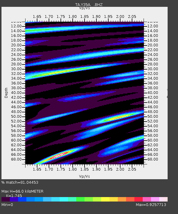
Y35A Marietta, OK, USA - Earthquake Result Viewer

Earthquake location: Off East Coast Of Honshu, Japan
Earthquake latitude/longitude: 36.8/143.8
Earthquake time(UTC): 2011/08/17 (229) 11:44:08 GMT
Earthquake Depth: 9.0 km
Earthquake Magnitude: 6.1 MB, 5.8 MS, 6.2 MW, 6.1 MW
Earthquake Catalog/Contributor: WHDF/NEIC
Network: TA USArray Transportable Network (new EarthScope stations)
Station: Y35A Marietta, OK, USA
Lat/Lon: 33.91 N/97.04 W
Elevation: 214 m
Distance: 89.7 deg
Az: 46.557 deg
Baz: 315.49 deg
Ray Param: 0.04172585
Estimated Moho Depth: 66.0 km
Estimated Crust Vp/Vs: 1.75
Assumed Crust Vp: 6.38 km/s
Estimated Crust Vs: 3.656 km/s
Estimated Crust Poisson's Ratio: 0.26
Radial Match: 81.04453 %
Radial Bump: 400
Transverse Match: 81.183556 %
Transverse Bump: 400
SOD ConfigId: 410809
Insert Time: 2012-01-06 06:57:53.572 +0000
GWidth: 2.5
Max Bumps: 400
Tol: 0.001

Signal To Noise

ChannelStoNSTALTA
TA:Y35A: :BHZ:20110817T11:56:35.200017Z9.5559271.1044245E-61.1557482E-7
TA:Y35A: :BHN:20110817T11:56:35.200017Z3.18755222.2303907E-76.997189E-8
TA:Y35A: :BHE:20110817T11:56:35.200017Z2.2150122.0747764E-79.366885E-8
Arrivals
Ps7.9 SECOND
PpPs28 SECOND
PsPs/PpSs36 SECOND