Y39A Lockesburg, AR, USA - Earthquake Result Viewer
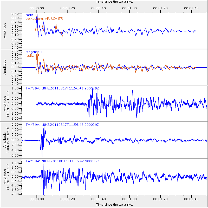
Earthquake location: Off East Coast Of Honshu, Japan
Earthquake latitude/longitude: 36.8/143.8
Earthquake time(UTC): 2011/08/17 (229) 11:44:08 GMT
Earthquake Depth: 9.0 km
Earthquake Magnitude: 6.1 MB, 5.8 MS, 6.2 MW, 6.1 MW
Earthquake Catalog/Contributor: WHDF/NEIC
Network: TA USArray Transportable Network (new EarthScope stations)
Station: Y39A Lockesburg, AR, USA
Lat/Lon: 33.94 N/94.09 W
Elevation: 108 m
Distance: 91.4 deg
Az: 44.765 deg
Baz: 317.142 deg
Ray Param: 0.04160691
Estimated Moho Depth: 10.0 km
Estimated Crust Vp/Vs: 2.05
Assumed Crust Vp: 6.245 km/s
Estimated Crust Vs: 3.05 km/s
Estimated Crust Poisson's Ratio: 0.34
Radial Match: 86.180664 %
Radial Bump: 400
Transverse Match: 85.03175 %
Transverse Bump: 400
SOD ConfigId: 410809
Insert Time: 2012-01-06 06:58:33.970 +0000
GWidth: 2.5
Max Bumps: 400
Tol: 0.001

Signal To Noise

ChannelStoNSTALTA
TA:Y39A: :BHZ:20110817T11:56:42.900029Z32.36672.3399707E-67.229562E-8
TA:Y39A: :BHN:20110817T11:56:42.900029Z8.2908536.085072E-77.339501E-8
TA:Y39A: :BHE:20110817T11:56:42.900029Z7.0739044.6442585E-76.5653396E-8
Arrivals
Ps1.7 SECOND
PpPs4.8 SECOND
PsPs/PpSs6.5 SECOND