O35A Humboldt, NE, USA - Earthquake Result Viewer
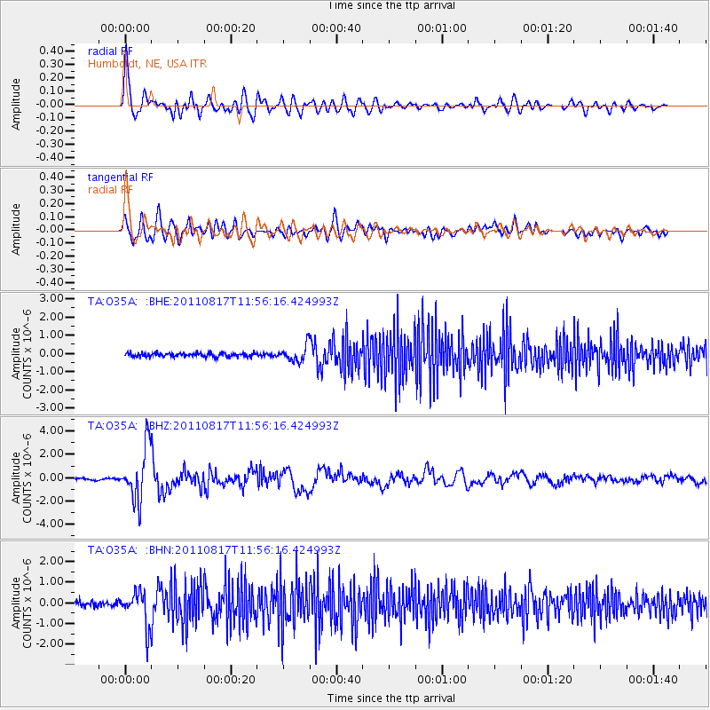
Earthquake location: Off East Coast Of Honshu, Japan
Earthquake latitude/longitude: 36.8/143.8
Earthquake time(UTC): 2011/08/17 (229) 11:44:08 GMT
Earthquake Depth: 9.0 km
Earthquake Magnitude: 6.1 MB, 5.8 MS, 6.2 MW, 6.1 MW
Earthquake Catalog/Contributor: WHDF/NEIC
Network: TA USArray Transportable Network (new EarthScope stations)
Station: O35A Humboldt, NE, USA
Lat/Lon: 40.27 N/95.91 W
Elevation: 342 m
Distance: 85.8 deg
Az: 41.476 deg
Baz: 315.968 deg
Ray Param: 0.044516653
Estimated Moho Depth: 41.0 km
Estimated Crust Vp/Vs: 1.60
Assumed Crust Vp: 6.498 km/s
Estimated Crust Vs: 4.061 km/s
Estimated Crust Poisson's Ratio: 0.18
Radial Match: 91.60526 %
Radial Bump: 400
Transverse Match: 82.75637 %
Transverse Bump: 400
SOD ConfigId: 410809
Insert Time: 2012-01-06 06:59:16.564 +0000
GWidth: 2.5
Max Bumps: 400
Tol: 0.001

Signal To Noise

ChannelStoNSTALTA
TA:O35A: :BHZ:20110817T11:56:16.424993Z27.560692.3109958E-68.385116E-8
TA:O35A: :BHN:20110817T11:56:16.424993Z7.1179858.469142E-71.189823E-7
TA:O35A: :BHE:20110817T11:56:16.424993Z4.344784.4195448E-71.017208E-7
Arrivals
Ps3.9 SECOND
PpPs16 SECOND
PsPs/PpSs20 SECOND