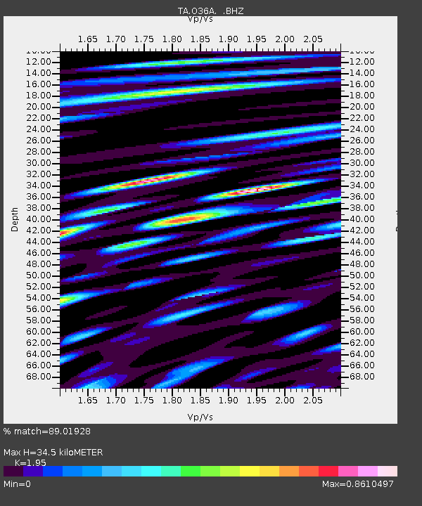
O36A Bolckow, MO, USA - Earthquake Result Viewer
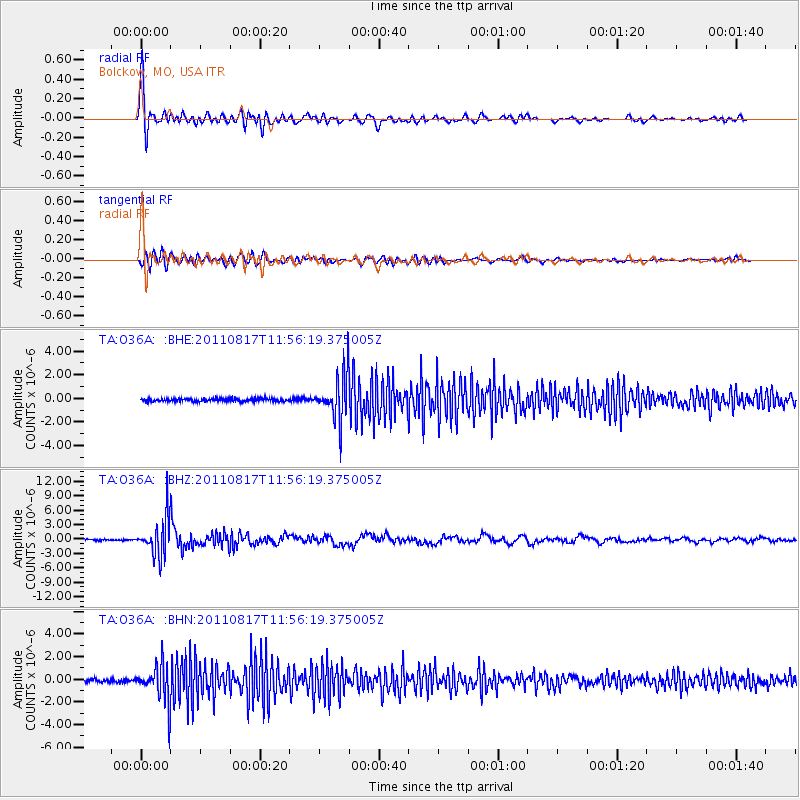
Earthquake location: Off East Coast Of Honshu, Japan
Earthquake latitude/longitude: 36.8/143.8
Earthquake time(UTC): 2011/08/17 (229) 11:44:08 GMT
Earthquake Depth: 9.0 km
Earthquake Magnitude: 6.1 MB, 5.8 MS, 6.2 MW, 6.1 MW
Earthquake Catalog/Contributor: WHDF/NEIC
Network: TA USArray Transportable Network (new EarthScope stations)
Station: O36A Bolckow, MO, USA
Lat/Lon: 40.13 N/94.96 W
Elevation: 306 m
Distance: 86.4 deg
Az: 41.045 deg
Baz: 316.546 deg
Ray Param: 0.044092197
Estimated Moho Depth: 34.5 km
Estimated Crust Vp/Vs: 1.95
Assumed Crust Vp: 6.498 km/s
Estimated Crust Vs: 3.332 km/s
Estimated Crust Poisson's Ratio: 0.32
Radial Match: 89.01928 %
Radial Bump: 400
Transverse Match: 71.57835 %
Transverse Bump: 400
SOD ConfigId: 410809
Insert Time: 2012-01-06 06:59:45.169 +0000
GWidth: 2.5
Max Bumps: 400
Tol: 0.001

Signal To Noise

ChannelStoNSTALTA
TA:O36A: :BHZ:20110817T11:56:19.375005Z32.7275853.8122125E-61.1648316E-7
TA:O36A: :BHN:20110817T11:56:19.375005Z12.3173931.6156619E-61.3116913E-7
TA:O36A: :BHE:20110817T11:56:19.375005Z15.8388591.9167253E-61.210141E-7
Arrivals
Ps5.2 SECOND
PpPs15 SECOND
PsPs/PpSs20 SECOND