
O33A Hebron, NE, USA - Earthquake Result Viewer
| ||||||||||||||||||
| ||||||||||||||||||
| ||||||||||||||||||
|
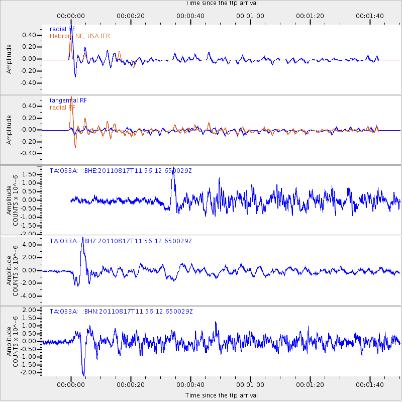
Signal To Noise
| Channel | StoN | STA | LTA |
| TA:O33A: :BHZ:20110817T11:56:12.650029Z | 36.22625 | 2.2363781E-6 | 6.173364E-8 |
| TA:O33A: :BHN:20110817T11:56:12.650029Z | 11.1503935 | 8.8314795E-7 | 7.9203296E-8 |
| TA:O33A: :BHE:20110817T11:56:12.650029Z | 7.7923665 | 7.392647E-7 | 9.4870366E-8 |
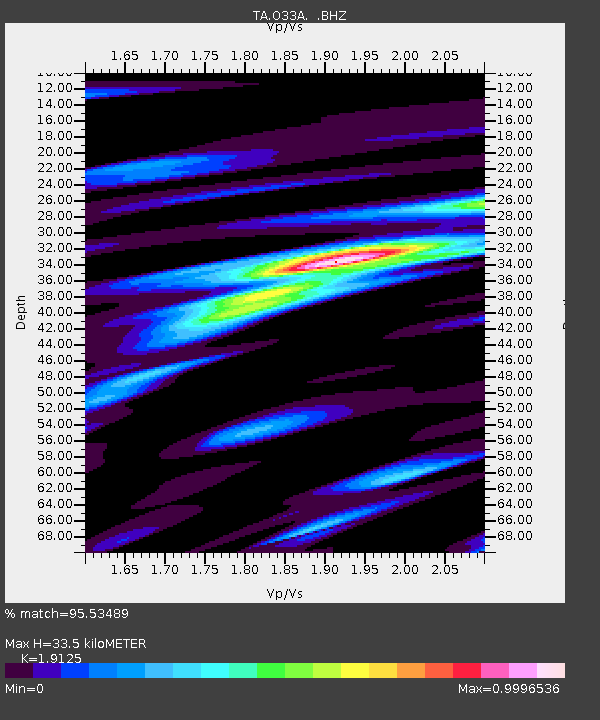
| Arrivals | |
| Ps | 4.8 SECOND |
| PpPs | 15 SECOND |
| PsPs/PpSs | 19 SECOND |

