
O34A Beatrice, NE, USA - Earthquake Result Viewer
| ||||||||||||||||||
| ||||||||||||||||||
| ||||||||||||||||||
|

Signal To Noise
| Channel | StoN | STA | LTA |
| TA:O34A: :BHZ:20110817T11:56:14.650029Z | 26.218922 | 2.0898508E-6 | 7.970773E-8 |
| TA:O34A: :BHN:20110817T11:56:14.650029Z | 5.8878036 | 5.884498E-7 | 9.994386E-8 |
| TA:O34A: :BHE:20110817T11:56:14.650029Z | 5.3277693 | 4.990377E-7 | 9.366728E-8 |
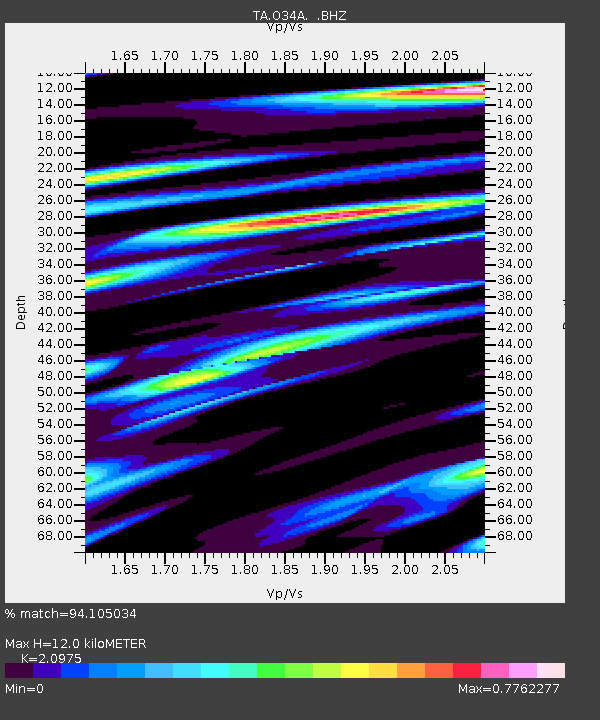
| Arrivals | |
| Ps | 2.1 SECOND |
| PpPs | 5.6 SECOND |
| PsPs/PpSs | 7.7 SECOND |

