V37A Hulbert, OK, USA - Earthquake Result Viewer
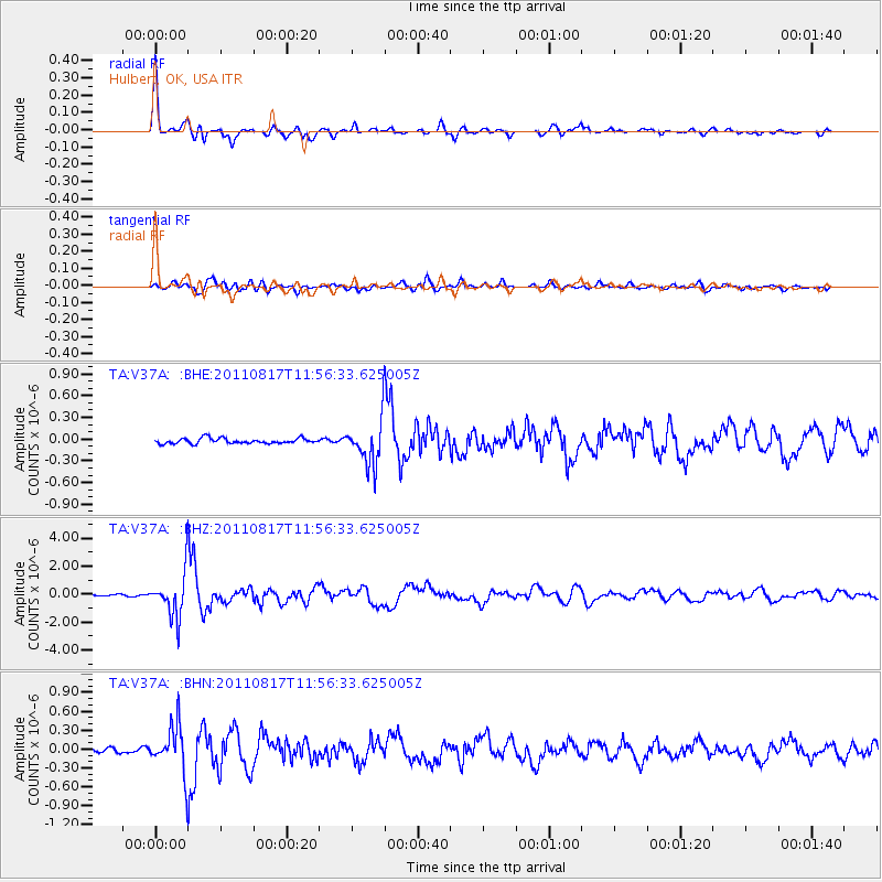
Earthquake location: Off East Coast Of Honshu, Japan
Earthquake latitude/longitude: 36.8/143.8
Earthquake time(UTC): 2011/08/17 (229) 11:44:08 GMT
Earthquake Depth: 9.0 km
Earthquake Magnitude: 6.1 MB, 5.8 MS, 6.2 MW, 6.1 MW
Earthquake Catalog/Contributor: WHDF/NEIC
Network: TA USArray Transportable Network (new EarthScope stations)
Station: V37A Hulbert, OK, USA
Lat/Lon: 35.88 N/95.14 W
Elevation: 219 m
Distance: 89.4 deg
Az: 44.065 deg
Baz: 316.55 deg
Ray Param: 0.041902974
Estimated Moho Depth: 45.25 km
Estimated Crust Vp/Vs: 1.65
Assumed Crust Vp: 6.498 km/s
Estimated Crust Vs: 3.932 km/s
Estimated Crust Poisson's Ratio: 0.21
Radial Match: 96.11598 %
Radial Bump: 368
Transverse Match: 84.532684 %
Transverse Bump: 400
SOD ConfigId: 410809
Insert Time: 2012-01-06 07:01:06.350 +0000
GWidth: 2.5
Max Bumps: 400
Tol: 0.001

Signal To Noise

ChannelStoNSTALTA
TA:V37A: :BHZ:20110817T11:56:33.625005Z23.1565591.556441E-66.721383E-8
TA:V37A: :BHN:20110817T11:56:33.625005Z9.3846963.7041121E-73.9469708E-8
TA:V37A: :BHE:20110817T11:56:33.625005Z8.7525973.1487565E-73.597511E-8
Arrivals
Ps4.6 SECOND
PpPs18 SECOND
PsPs/PpSs23 SECOND