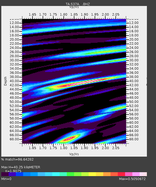
S37A Fort Scott, KS, USA - Earthquake Result Viewer
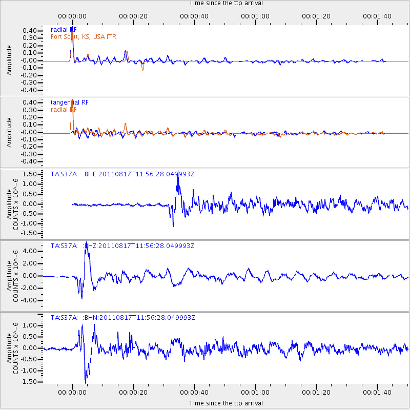
Earthquake location: Off East Coast Of Honshu, Japan
Earthquake latitude/longitude: 36.8/143.8
Earthquake time(UTC): 2011/08/17 (229) 11:44:08 GMT
Earthquake Depth: 9.0 km
Earthquake Magnitude: 6.1 MB, 5.8 MS, 6.2 MW, 6.1 MW
Earthquake Catalog/Contributor: WHDF/NEIC
Network: TA USArray Transportable Network (new EarthScope stations)
Station: S37A Fort Scott, KS, USA
Lat/Lon: 37.76 N/94.83 W
Elevation: 260 m
Distance: 88.2 deg
Az: 42.596 deg
Baz: 316.705 deg
Ray Param: 0.042781148
Estimated Moho Depth: 40.25 km
Estimated Crust Vp/Vs: 1.91
Assumed Crust Vp: 6.53 km/s
Estimated Crust Vs: 3.424 km/s
Estimated Crust Poisson's Ratio: 0.31
Radial Match: 96.64282 %
Radial Bump: 398
Transverse Match: 84.6647 %
Transverse Bump: 400
SOD ConfigId: 410809
Insert Time: 2012-01-06 07:02:06.130 +0000
GWidth: 2.5
Max Bumps: 400
Tol: 0.001

Signal To Noise

ChannelStoNSTALTA
TA:S37A: :BHZ:20110817T11:56:28.049993Z36.4013142.1445567E-65.8914267E-8
TA:S37A: :BHN:20110817T11:56:28.049993Z13.0176885.8563865E-74.4987914E-8
TA:S37A: :BHE:20110817T11:56:28.049993Z16.5670135.296667E-73.197116E-8
Arrivals
Ps5.7 SECOND
PpPs18 SECOND
PsPs/PpSs23 SECOND