J01D Myrtle Point, OR, USA - Earthquake Result Viewer
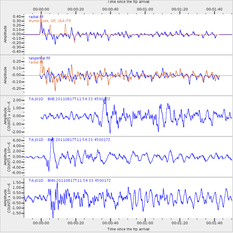
Earthquake location: Off East Coast Of Honshu, Japan
Earthquake latitude/longitude: 36.8/143.8
Earthquake time(UTC): 2011/08/17 (229) 11:44:08 GMT
Earthquake Depth: 9.0 km
Earthquake Magnitude: 6.1 MB, 5.8 MS, 6.2 MW, 6.1 MW
Earthquake Catalog/Contributor: WHDF/NEIC
Network: TA USArray Transportable Network (new EarthScope stations)
Station: J01D Myrtle Point, OR, USA
Lat/Lon: 43.16 N/123.93 W
Elevation: 131 m
Distance: 67.5 deg
Az: 52.312 deg
Baz: 299.719 deg
Ray Param: 0.056916326
Estimated Moho Depth: 26.0 km
Estimated Crust Vp/Vs: 2.10
Assumed Crust Vp: 6.522 km/s
Estimated Crust Vs: 3.109 km/s
Estimated Crust Poisson's Ratio: 0.35
Radial Match: 84.05295 %
Radial Bump: 400
Transverse Match: 75.37435 %
Transverse Bump: 400
SOD ConfigId: 410809
Insert Time: 2012-01-06 07:05:06.625 +0000
GWidth: 2.5
Max Bumps: 400
Tol: 0.001

Signal To Noise

ChannelStoNSTALTA
TA:J01D: :BHZ:20110817T11:54:33.450017Z8.3472241.7430577E-62.0881886E-7
TA:J01D: :BHN:20110817T11:54:33.450017Z1.62116723.124907E-71.9275663E-7
TA:J01D: :BHE:20110817T11:54:33.450017Z2.63687425.8862514E-72.2322835E-7
Arrivals
Ps4.5 SECOND
PpPs12 SECOND
PsPs/PpSs16 SECOND