DRV Dumont d'Urville, Terre Adelie (Antartica) - Earthquake Result Viewer
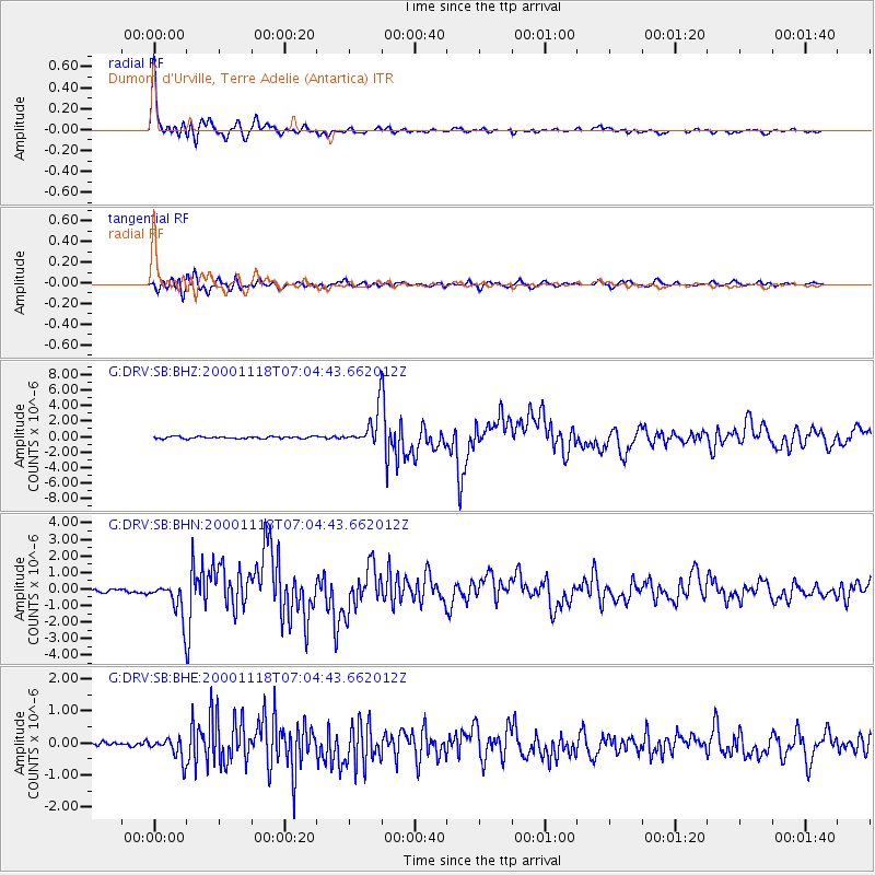
Earthquake location: New Britain Region, P.N.G.
Earthquake latitude/longitude: -5.2/151.8
Earthquake time(UTC): 2000/11/18 (323) 06:54:58 GMT
Earthquake Depth: 33 km
Earthquake Magnitude: 6.2 MB, 6.6 MS, 6.8 MW, 6.8 MW
Earthquake Catalog/Contributor: WHDF/NEIC
Network: G GEOSCOPE
Station: DRV Dumont d'Urville, Terre Adelie (Antartica)
Lat/Lon: 66.67 S/140.01 E
Elevation: 40 m
Distance: 61.9 deg
Az: 185.283 deg
Baz: 13.307 deg
Ray Param: 0.06054341
Estimated Moho Depth: 50.75 km
Estimated Crust Vp/Vs: 2.04
Assumed Crust Vp: 6.39 km/s
Estimated Crust Vs: 3.14 km/s
Estimated Crust Poisson's Ratio: 0.34
Radial Match: 96.76451 %
Radial Bump: 343
Transverse Match: 89.29906 %
Transverse Bump: 400
SOD ConfigId: 3744
Insert Time: 2010-02-26 22:05:32.430 +0000
GWidth: 2.5
Max Bumps: 400
Tol: 0.001

Signal To Noise

ChannelStoNSTALTA
G:DRV:SB:BHN:20001118T07:04:43.662012Z8.9882081.0653405E-61.1852646E-7
G:DRV:SB:BHE:20001118T07:04:43.662012Z3.32462673.324283E-79.998966E-8
G:DRV:SB:BHZ:20001118T07:04:43.662012Z15.2890721.9761944E-61.2925535E-7
Arrivals
Ps8.5 SECOND
PpPs23 SECOND
PsPs/PpSs32 SECOND