E31A Nome, ND, USA - Earthquake Result Viewer
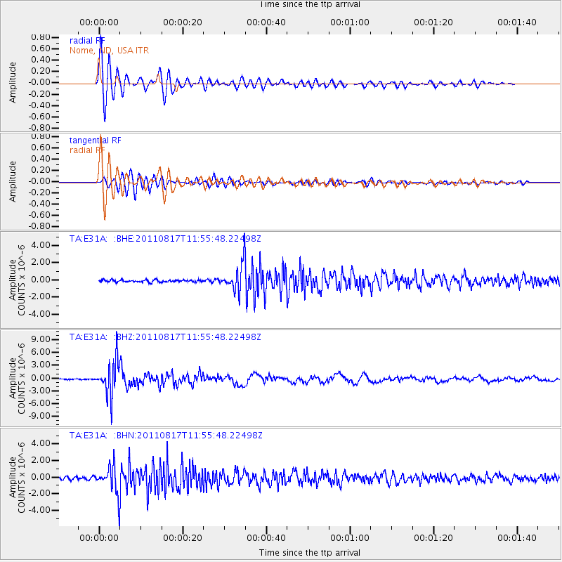
Earthquake location: Off East Coast Of Honshu, Japan
Earthquake latitude/longitude: 36.8/143.8
Earthquake time(UTC): 2011/08/17 (229) 11:44:08 GMT
Earthquake Depth: 9.0 km
Earthquake Magnitude: 6.1 MB, 5.8 MS, 6.2 MW, 6.1 MW
Earthquake Catalog/Contributor: WHDF/NEIC
Network: TA USArray Transportable Network (new EarthScope stations)
Station: E31A Nome, ND, USA
Lat/Lon: 46.56 N/97.89 W
Elevation: 427 m
Distance: 80.3 deg
Az: 38.033 deg
Baz: 314.194 deg
Ray Param: 0.0483638
Estimated Moho Depth: 30.75 km
Estimated Crust Vp/Vs: 1.89
Assumed Crust Vp: 6.498 km/s
Estimated Crust Vs: 3.438 km/s
Estimated Crust Poisson's Ratio: 0.31
Radial Match: 94.767876 %
Radial Bump: 400
Transverse Match: 86.99366 %
Transverse Bump: 400
SOD ConfigId: 410809
Insert Time: 2012-01-06 07:05:59.568 +0000
GWidth: 2.5
Max Bumps: 400
Tol: 0.001

Signal To Noise

ChannelStoNSTALTA
TA:E31A: :BHZ:20110817T11:55:48.22498Z41.692183.9718598E-69.5266294E-8
TA:E31A: :BHN:20110817T11:55:48.22498Z9.7833381.6645736E-61.7014374E-7
TA:E31A: :BHE:20110817T11:55:48.22498Z13.519551.6479279E-61.2189221E-7
Arrivals
Ps4.3 SECOND
PpPs13 SECOND
PsPs/PpSs18 SECOND