DRV Dumont d'Urville, Terre Adelie (Antartica) - Earthquake Result Viewer
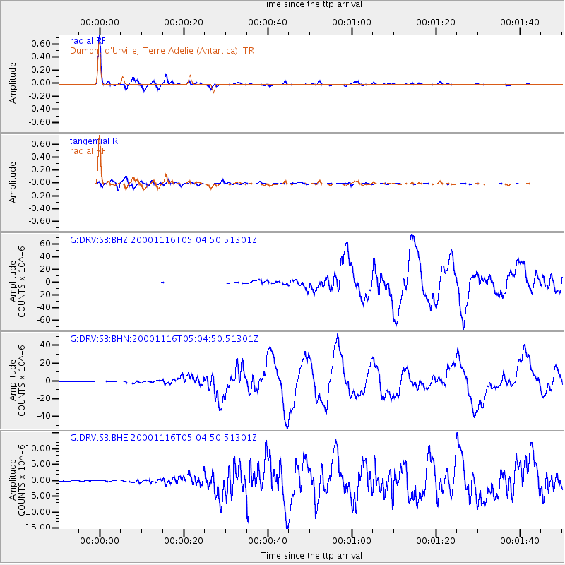
Earthquake location: New Ireland Region, P.N.G.
Earthquake latitude/longitude: -4.0/152.2
Earthquake time(UTC): 2000/11/16 (321) 04:54:56 GMT
Earthquake Depth: 33 km
Earthquake Magnitude: 6.0 MB, 8.2 MS, 8.0 MW, 8.0 ME
Earthquake Catalog/Contributor: WHDF/NEIC
Network: G GEOSCOPE
Station: DRV Dumont d'Urville, Terre Adelie (Antartica)
Lat/Lon: 66.67 S/140.01 E
Elevation: 40 m
Distance: 63.1 deg
Az: 185.396 deg
Baz: 13.623 deg
Ray Param: 0.05971277
Estimated Moho Depth: 22.75 km
Estimated Crust Vp/Vs: 1.60
Assumed Crust Vp: 6.39 km/s
Estimated Crust Vs: 3.994 km/s
Estimated Crust Poisson's Ratio: 0.18
Radial Match: 98.98024 %
Radial Bump: 196
Transverse Match: 92.288216 %
Transverse Bump: 400
SOD ConfigId: 3744
Insert Time: 2010-02-26 22:05:34.487 +0000
GWidth: 2.5
Max Bumps: 400
Tol: 0.001

Signal To Noise

ChannelStoNSTALTA
G:DRV:SB:BHN:20001116T05:04:50.51301Z2.51623494.4088742E-71.7521711E-7
G:DRV:SB:BHE:20001116T05:04:50.51301Z2.58534881.9898414E-77.6966074E-8
G:DRV:SB:BHZ:20001116T05:04:50.51301Z4.90280777.5355865E-71.536994E-7
Arrivals
Ps2.2 SECOND
PpPs8.8 SECOND
PsPs/PpSs11 SECOND