E34A Wadena, MN, USA - Earthquake Result Viewer
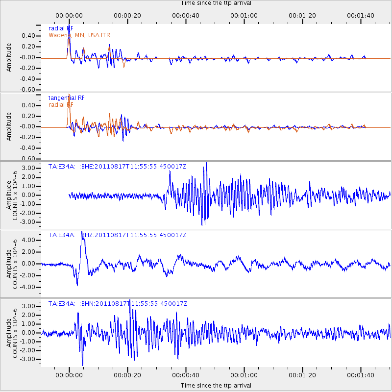
Earthquake location: Off East Coast Of Honshu, Japan
Earthquake latitude/longitude: 36.8/143.8
Earthquake time(UTC): 2011/08/17 (229) 11:44:08 GMT
Earthquake Depth: 9.0 km
Earthquake Magnitude: 6.1 MB, 5.8 MS, 6.2 MW, 6.1 MW
Earthquake Catalog/Contributor: WHDF/NEIC
Network: TA USArray Transportable Network (new EarthScope stations)
Station: E34A Wadena, MN, USA
Lat/Lon: 46.51 N/95.17 W
Elevation: 430 m
Distance: 81.7 deg
Az: 36.72 deg
Baz: 315.956 deg
Ray Param: 0.047425497
Estimated Moho Depth: 30.25 km
Estimated Crust Vp/Vs: 2.01
Assumed Crust Vp: 6.419 km/s
Estimated Crust Vs: 3.202 km/s
Estimated Crust Poisson's Ratio: 0.33
Radial Match: 80.022644 %
Radial Bump: 400
Transverse Match: 50.594807 %
Transverse Bump: 400
SOD ConfigId: 410809
Insert Time: 2012-01-06 07:07:21.493 +0000
GWidth: 2.5
Max Bumps: 400
Tol: 0.001

Signal To Noise

ChannelStoNSTALTA
TA:E34A: :BHZ:20110817T11:55:55.450017Z21.225112.2019726E-61.0374376E-7
TA:E34A: :BHN:20110817T11:55:55.450017Z8.9020241.1884515E-61.3350352E-7
TA:E34A: :BHE:20110817T11:55:55.450017Z4.801558.2088957E-71.7096345E-7
Arrivals
Ps4.9 SECOND
PpPs14 SECOND
PsPs/PpSs19 SECOND