
G35A Watkins, MN, USA - Earthquake Result Viewer
| ||||||||||||||||||
| ||||||||||||||||||
| ||||||||||||||||||
|
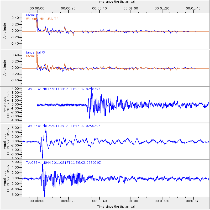
Signal To Noise
| Channel | StoN | STA | LTA |
| TA:G35A: :BHZ:20110817T11:56:02.025029Z | 30.959179 | 3.0285848E-6 | 9.7825094E-8 |
| TA:G35A: :BHN:20110817T11:56:02.025029Z | 15.200194 | 2.0880357E-6 | 1.3736901E-7 |
| TA:G35A: :BHE:20110817T11:56:02.025029Z | 14.7417555 | 1.4420583E-6 | 9.782134E-8 |
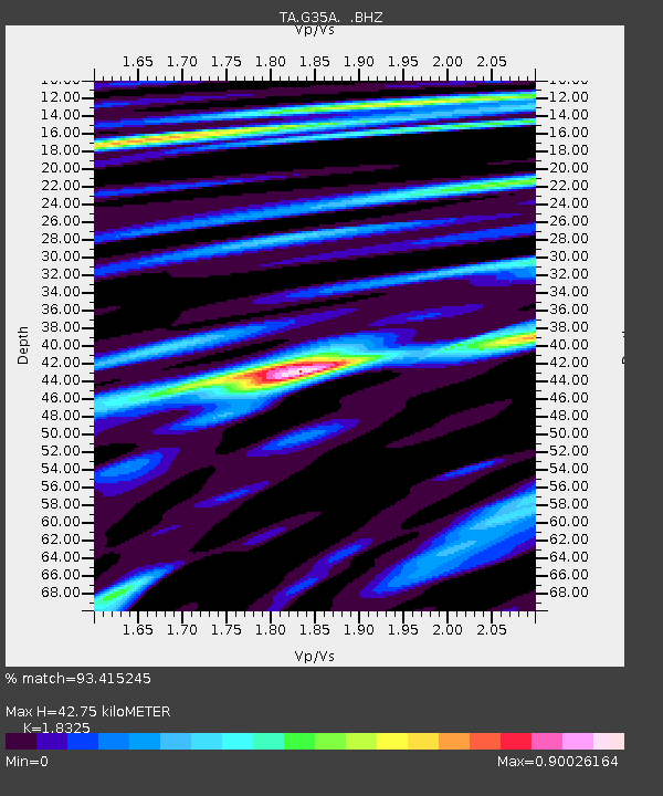
| Arrivals | |
| Ps | 5.6 SECOND |
| PpPs | 18 SECOND |
| PsPs/PpSs | 24 SECOND |

