A33A Warroad, MN, USA - Earthquake Result Viewer
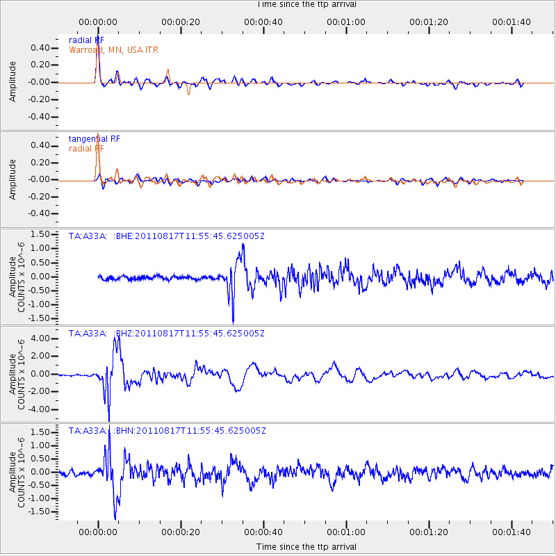
Earthquake location: Off East Coast Of Honshu, Japan
Earthquake latitude/longitude: 36.8/143.8
Earthquake time(UTC): 2011/08/17 (229) 11:44:08 GMT
Earthquake Depth: 9.0 km
Earthquake Magnitude: 6.1 MB, 5.8 MS, 6.2 MW, 6.1 MW
Earthquake Catalog/Contributor: WHDF/NEIC
Network: TA USArray Transportable Network (new EarthScope stations)
Station: A33A Warroad, MN, USA
Lat/Lon: 48.94 N/95.39 W
Elevation: 329 m
Distance: 79.8 deg
Az: 35.114 deg
Baz: 315.534 deg
Ray Param: 0.048694957
Estimated Moho Depth: 48.0 km
Estimated Crust Vp/Vs: 1.62
Assumed Crust Vp: 6.419 km/s
Estimated Crust Vs: 3.95 km/s
Estimated Crust Poisson's Ratio: 0.20
Radial Match: 94.94646 %
Radial Bump: 400
Transverse Match: 77.379555 %
Transverse Bump: 400
SOD ConfigId: 410809
Insert Time: 2012-01-06 07:10:38.836 +0000
GWidth: 2.5
Max Bumps: 400
Tol: 0.001

Signal To Noise

ChannelStoNSTALTA
TA:A33A: :BHZ:20110817T11:55:45.625005Z28.3898072.213879E-67.798147E-8
TA:A33A: :BHN:20110817T11:55:45.625005Z12.526777.695795E-76.143479E-8
TA:A33A: :BHE:20110817T11:55:45.625005Z11.1274165.9516833E-75.3486666E-8
Arrivals
Ps4.8 SECOND
PpPs19 SECOND
PsPs/PpSs24 SECOND