G33A Ortonville, MN, USA - Earthquake Result Viewer
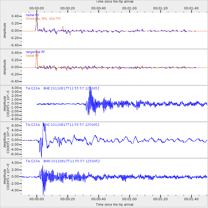
Earthquake location: Off East Coast Of Honshu, Japan
Earthquake latitude/longitude: 36.8/143.8
Earthquake time(UTC): 2011/08/17 (229) 11:44:08 GMT
Earthquake Depth: 9.0 km
Earthquake Magnitude: 6.1 MB, 5.8 MS, 6.2 MW, 6.1 MW
Earthquake Catalog/Contributor: WHDF/NEIC
Network: TA USArray Transportable Network (new EarthScope stations)
Station: G33A Ortonville, MN, USA
Lat/Lon: 45.19 N/96.44 W
Elevation: 338 m
Distance: 82.0 deg
Az: 38.292 deg
Baz: 315.271 deg
Ray Param: 0.047199022
Estimated Moho Depth: 25.5 km
Estimated Crust Vp/Vs: 1.70
Assumed Crust Vp: 6.552 km/s
Estimated Crust Vs: 3.854 km/s
Estimated Crust Poisson's Ratio: 0.24
Radial Match: 97.72125 %
Radial Bump: 400
Transverse Match: 82.89471 %
Transverse Bump: 400
SOD ConfigId: 410809
Insert Time: 2012-01-06 07:11:03.952 +0000
GWidth: 2.5
Max Bumps: 400
Tol: 0.001

Signal To Noise

ChannelStoNSTALTA
TA:G33A: :BHZ:20110817T11:55:57.125005Z42.0313383.2493247E-67.730719E-8
TA:G33A: :BHN:20110817T11:55:57.125005Z23.5223351.4984871E-66.370486E-8
TA:G33A: :BHE:20110817T11:55:57.125005Z25.5393311.4063102E-65.5064483E-8
Arrivals
Ps2.8 SECOND
PpPs10 SECOND
PsPs/PpSs13 SECOND