S39A Bolivar, MO, USA - Earthquake Result Viewer
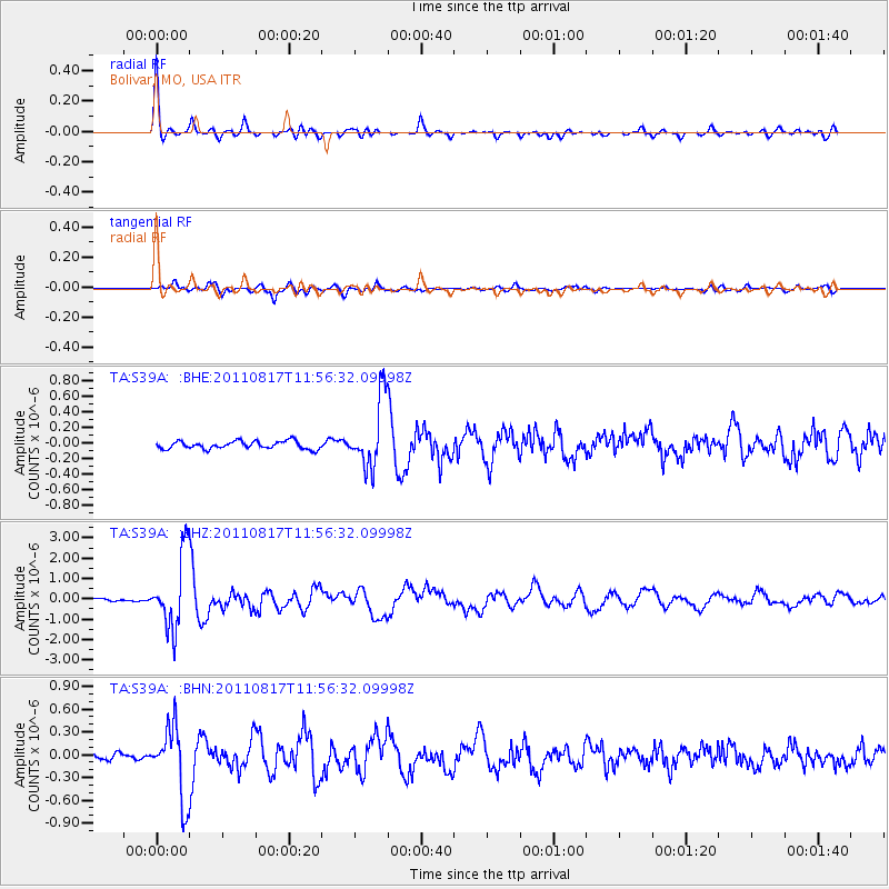
Earthquake location: Off East Coast Of Honshu, Japan
Earthquake latitude/longitude: 36.8/143.8
Earthquake time(UTC): 2011/08/17 (229) 11:44:08 GMT
Earthquake Depth: 9.0 km
Earthquake Magnitude: 6.1 MB, 5.8 MS, 6.2 MW, 6.1 MW
Earthquake Catalog/Contributor: WHDF/NEIC
Network: TA USArray Transportable Network (new EarthScope stations)
Station: S39A Bolivar, MO, USA
Lat/Lon: 37.69 N/93.32 W
Elevation: 331 m
Distance: 89.0 deg
Az: 41.767 deg
Baz: 317.603 deg
Ray Param: 0.04214148
Estimated Moho Depth: 47.0 km
Estimated Crust Vp/Vs: 1.74
Assumed Crust Vp: 6.53 km/s
Estimated Crust Vs: 3.748 km/s
Estimated Crust Poisson's Ratio: 0.25
Radial Match: 95.17795 %
Radial Bump: 391
Transverse Match: 87.03182 %
Transverse Bump: 400
SOD ConfigId: 410809
Insert Time: 2012-01-06 07:15:01.426 +0000
GWidth: 2.5
Max Bumps: 400
Tol: 0.001

Signal To Noise

ChannelStoNSTALTA
TA:S39A: :BHZ:20110817T11:56:32.09998Z34.829751.8087107E-65.1930055E-8
TA:S39A: :BHN:20110817T11:56:32.09998Z11.0051554.7227226E-74.2913733E-8
TA:S39A: :BHE:20110817T11:56:32.09998Z8.8859274.4019694E-74.9538663E-8
Arrivals
Ps5.5 SECOND
PpPs19 SECOND
PsPs/PpSs25 SECOND