S40A Lebanon, MO, USA - Earthquake Result Viewer
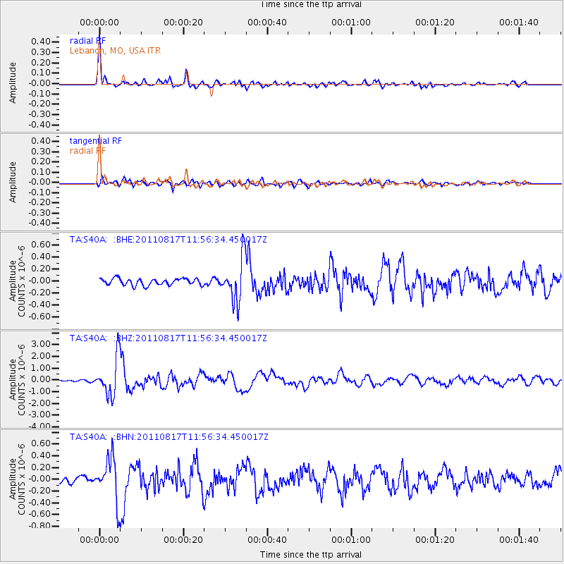
Earthquake location: Off East Coast Of Honshu, Japan
Earthquake latitude/longitude: 36.8/143.8
Earthquake time(UTC): 2011/08/17 (229) 11:44:08 GMT
Earthquake Depth: 9.0 km
Earthquake Magnitude: 6.1 MB, 5.8 MS, 6.2 MW, 6.1 MW
Earthquake Catalog/Contributor: WHDF/NEIC
Network: TA USArray Transportable Network (new EarthScope stations)
Station: S40A Lebanon, MO, USA
Lat/Lon: 37.60 N/92.50 W
Elevation: 336 m
Distance: 89.5 deg
Az: 41.346 deg
Baz: 318.097 deg
Ray Param: 0.04177279
Estimated Moho Depth: 51.0 km
Estimated Crust Vp/Vs: 1.73
Assumed Crust Vp: 6.53 km/s
Estimated Crust Vs: 3.786 km/s
Estimated Crust Poisson's Ratio: 0.25
Radial Match: 95.0631 %
Radial Bump: 400
Transverse Match: 80.98331 %
Transverse Bump: 400
SOD ConfigId: 410809
Insert Time: 2012-01-06 07:15:16.439 +0000
GWidth: 2.5
Max Bumps: 400
Tol: 0.001

Signal To Noise

ChannelStoNSTALTA
TA:S40A: :BHZ:20110817T11:56:34.450017Z32.0474781.6477151E-65.1414812E-8
TA:S40A: :BHN:20110817T11:56:34.450017Z7.76014853.8023117E-74.8997926E-8
TA:S40A: :BHE:20110817T11:56:34.450017Z6.72163.718283E-75.531842E-8
Arrivals
Ps5.8 SECOND
PpPs21 SECOND
PsPs/PpSs27 SECOND