Y40A Okolona, AR, USA - Earthquake Result Viewer
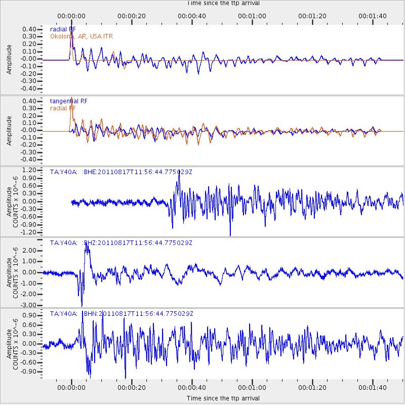
Earthquake location: Off East Coast Of Honshu, Japan
Earthquake latitude/longitude: 36.8/143.8
Earthquake time(UTC): 2011/08/17 (229) 11:44:08 GMT
Earthquake Depth: 9.0 km
Earthquake Magnitude: 6.1 MB, 5.8 MS, 6.2 MW, 6.1 MW
Earthquake Catalog/Contributor: WHDF/NEIC
Network: TA USArray Transportable Network (new EarthScope stations)
Station: Y40A Okolona, AR, USA
Lat/Lon: 34.01 N/93.28 W
Elevation: 117 m
Distance: 91.8 deg
Az: 44.216 deg
Baz: 317.61 deg
Ray Param: 0.041558944
Estimated Moho Depth: 11.75 km
Estimated Crust Vp/Vs: 1.60
Assumed Crust Vp: 6.498 km/s
Estimated Crust Vs: 4.061 km/s
Estimated Crust Poisson's Ratio: 0.18
Radial Match: 89.97117 %
Radial Bump: 400
Transverse Match: 79.310036 %
Transverse Bump: 400
SOD ConfigId: 410809
Insert Time: 2012-01-06 07:15:54.445 +0000
GWidth: 2.5
Max Bumps: 400
Tol: 0.001

Signal To Noise

ChannelStoNSTALTA
TA:Y40A: :BHZ:20110817T11:56:44.775029Z11.2199221.1349684E-61.0115654E-7
TA:Y40A: :BHN:20110817T11:56:44.775029Z3.95866942.834624E-77.160548E-8
TA:Y40A: :BHE:20110817T11:56:44.775029Z5.18778663.1200128E-76.01415E-8
Arrivals
Ps1.1 SECOND
PpPs4.6 SECOND
PsPs/PpSs5.7 SECOND