
U39A Green Forest, AR, USA - Earthquake Result Viewer
| ||||||||||||||||||
| ||||||||||||||||||
| ||||||||||||||||||
|
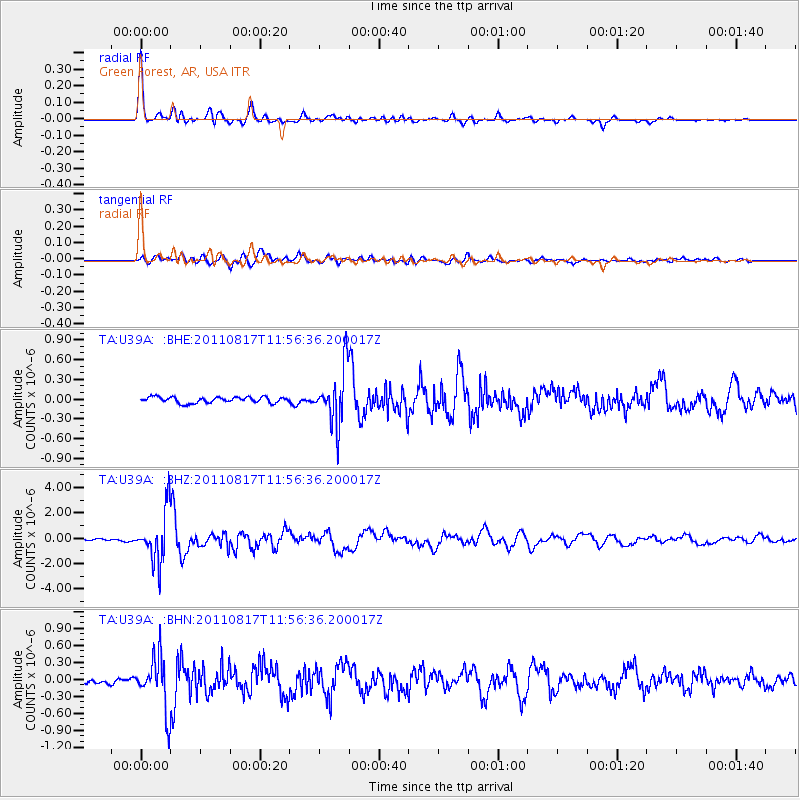
Signal To Noise
| Channel | StoN | STA | LTA |
| TA:U39A: :BHZ:20110817T11:56:36.200017Z | 29.636404 | 1.9973638E-6 | 6.7395625E-8 |
| TA:U39A: :BHN:20110817T11:56:36.200017Z | 8.501833 | 4.682104E-7 | 5.50717E-8 |
| TA:U39A: :BHE:20110817T11:56:36.200017Z | 9.504725 | 4.1868662E-7 | 4.4050363E-8 |
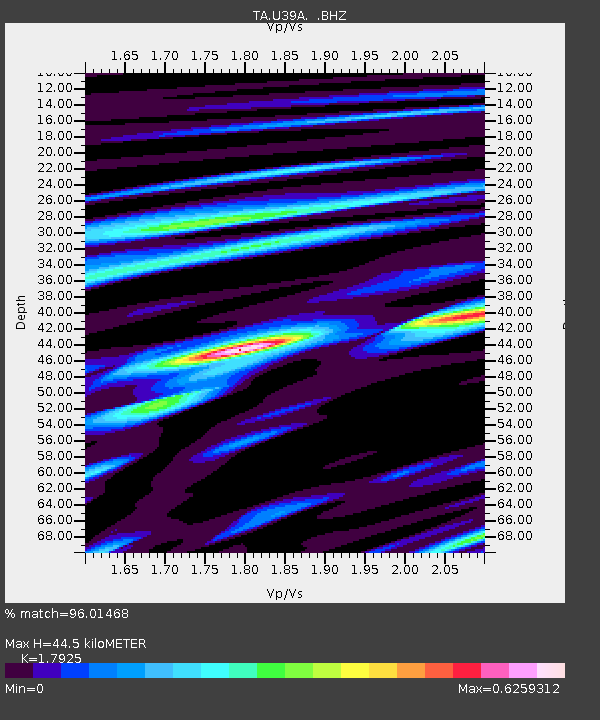
| Arrivals | |
| Ps | 5.5 SECOND |
| PpPs | 19 SECOND |
| PsPs/PpSs | 24 SECOND |

