W39A Magazine, AR, USA - Earthquake Result Viewer
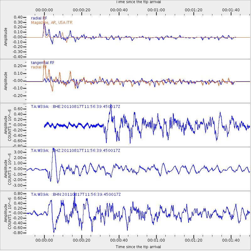
Earthquake location: Off East Coast Of Honshu, Japan
Earthquake latitude/longitude: 36.8/143.8
Earthquake time(UTC): 2011/08/17 (229) 11:44:08 GMT
Earthquake Depth: 9.0 km
Earthquake Magnitude: 6.1 MB, 5.8 MS, 6.2 MW, 6.1 MW
Earthquake Catalog/Contributor: WHDF/NEIC
Network: TA USArray Transportable Network (new EarthScope stations)
Station: W39A Magazine, AR, USA
Lat/Lon: 35.20 N/93.78 W
Elevation: 162 m
Distance: 90.6 deg
Az: 43.725 deg
Baz: 317.335 deg
Ray Param: 0.041660257
Estimated Moho Depth: 19.5 km
Estimated Crust Vp/Vs: 1.82
Assumed Crust Vp: 6.498 km/s
Estimated Crust Vs: 3.575 km/s
Estimated Crust Poisson's Ratio: 0.28
Radial Match: 91.143166 %
Radial Bump: 400
Transverse Match: 75.14489 %
Transverse Bump: 400
SOD ConfigId: 410809
Insert Time: 2012-01-06 07:16:32.721 +0000
GWidth: 2.5
Max Bumps: 400
Tol: 0.001

Signal To Noise

ChannelStoNSTALTA
TA:W39A: :BHZ:20110817T11:56:39.450017Z13.8315351.3761728E-69.94953E-8
TA:W39A: :BHN:20110817T11:56:39.450017Z4.1324372.8568692E-76.9132795E-8
TA:W39A: :BHE:20110817T11:56:39.450017Z4.17556052.1275041E-75.095134E-8
Arrivals
Ps2.5 SECOND
PpPs8.3 SECOND
PsPs/PpSs11 SECOND