
DRV Dumont d'Urville, Terre Adelie (Antartica) - Earthquake Result Viewer
| ||||||||||||||||||
| ||||||||||||||||||
| ||||||||||||||||||
|
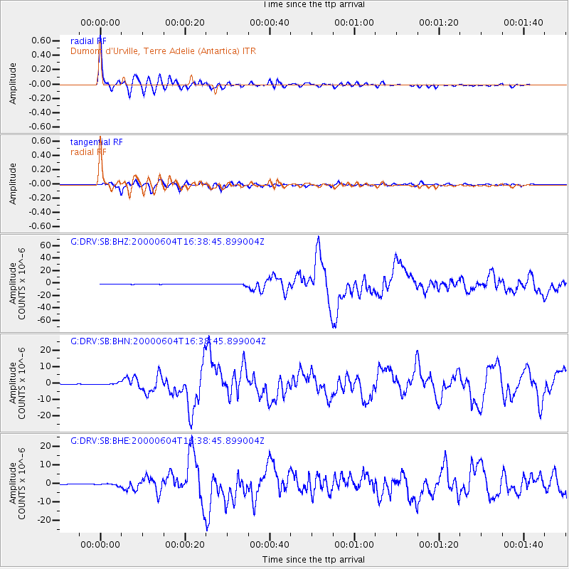
Signal To Noise
| Channel | StoN | STA | LTA |
| G:DRV:SB:BHN:20000604T16:38:45.899004Z | 3.5193026 | 5.663071E-7 | 1.609146E-7 |
| G:DRV:SB:BHE:20000604T16:38:45.899004Z | 3.239331 | 5.481014E-7 | 1.6920205E-7 |
| G:DRV:SB:BHZ:20000604T16:38:45.899004Z | 5.8691826 | 1.4486798E-6 | 2.4682822E-7 |
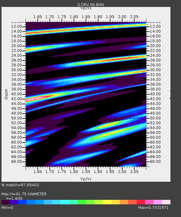
| Arrivals | |
| Ps | 4.3 SECOND |
| PpPs | 16 SECOND |
| PsPs/PpSs | 21 SECOND |

