
TPFO Pinon Flats, CA, USA - Earthquake Result Viewer
| ||||||||||||||||||
| ||||||||||||||||||
| ||||||||||||||||||
|
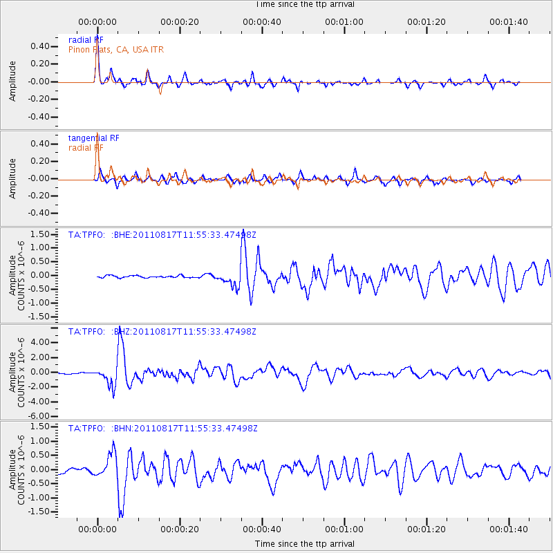
Signal To Noise
| Channel | StoN | STA | LTA |
| TA:TPFO: :BHZ:20110817T11:55:33.47498Z | 8.660235 | 1.3033091E-6 | 1.5049349E-7 |
| TA:TPFO: :BHN:20110817T11:55:33.47498Z | 3.5655015 | 4.4036028E-7 | 1.2350586E-7 |
| TA:TPFO: :BHE:20110817T11:55:33.47498Z | 7.8282285 | 2.8904068E-7 | 3.692287E-8 |
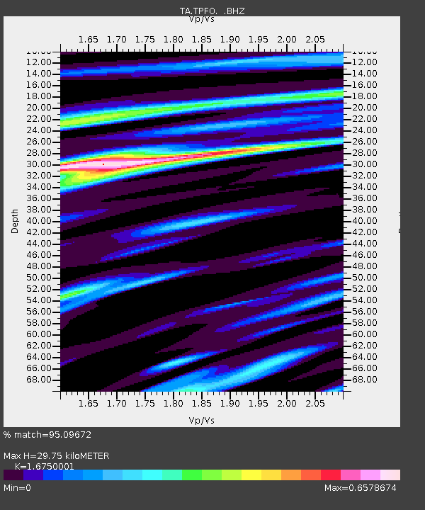
| Arrivals | |
| Ps | 3.3 SECOND |
| PpPs | 12 SECOND |
| PsPs/PpSs | 16 SECOND |

