Y41A Eaglette Bearden, AR, USA - Earthquake Result Viewer
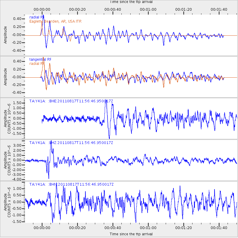
Earthquake location: Off East Coast Of Honshu, Japan
Earthquake latitude/longitude: 36.8/143.8
Earthquake time(UTC): 2011/08/17 (229) 11:44:08 GMT
Earthquake Depth: 9.0 km
Earthquake Magnitude: 6.1 MB, 5.8 MS, 6.2 MW, 6.1 MW
Earthquake Catalog/Contributor: WHDF/NEIC
Network: TA USArray Transportable Network (new EarthScope stations)
Station: Y41A Eaglette Bearden, AR, USA
Lat/Lon: 33.88 N/92.61 W
Elevation: 99 m
Distance: 92.2 deg
Az: 43.893 deg
Baz: 317.993 deg
Ray Param: 0.041487604
Estimated Moho Depth: 39.0 km
Estimated Crust Vp/Vs: 1.71
Assumed Crust Vp: 6.245 km/s
Estimated Crust Vs: 3.657 km/s
Estimated Crust Poisson's Ratio: 0.24
Radial Match: 93.83947 %
Radial Bump: 400
Transverse Match: 88.50425 %
Transverse Bump: 400
SOD ConfigId: 410809
Insert Time: 2012-01-06 07:21:00.105 +0000
GWidth: 2.5
Max Bumps: 400
Tol: 0.001

Signal To Noise

ChannelStoNSTALTA
TA:Y41A: :BHZ:20110817T11:56:46.950017Z14.0141031.295847E-69.246735E-8
TA:Y41A: :BHN:20110817T11:56:46.950017Z2.43741443.4545633E-71.4173065E-7
TA:Y41A: :BHE:20110817T11:56:46.950017Z1.75117332.8159167E-71.6080172E-7
Arrivals
Ps4.5 SECOND
PpPs17 SECOND
PsPs/PpSs21 SECOND