P39B Salisbury, MO, USA - Earthquake Result Viewer
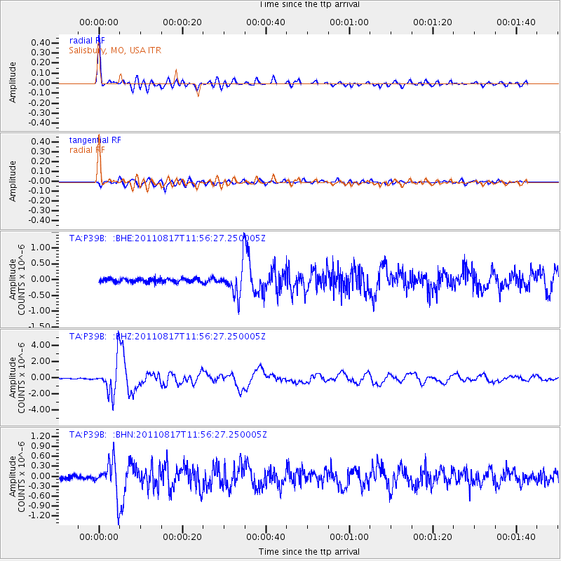
Earthquake location: Off East Coast Of Honshu, Japan
Earthquake latitude/longitude: 36.8/143.8
Earthquake time(UTC): 2011/08/17 (229) 11:44:08 GMT
Earthquake Depth: 9.0 km
Earthquake Magnitude: 6.1 MB, 5.8 MS, 6.2 MW, 6.1 MW
Earthquake Catalog/Contributor: WHDF/NEIC
Network: TA USArray Transportable Network (new EarthScope stations)
Station: P39B Salisbury, MO, USA
Lat/Lon: 39.49 N/92.75 W
Elevation: 226 m
Distance: 88.0 deg
Az: 40.231 deg
Baz: 317.916 deg
Ray Param: 0.042905014
Estimated Moho Depth: 22.5 km
Estimated Crust Vp/Vs: 1.73
Assumed Crust Vp: 6.498 km/s
Estimated Crust Vs: 3.761 km/s
Estimated Crust Poisson's Ratio: 0.25
Radial Match: 96.214325 %
Radial Bump: 400
Transverse Match: 87.97343 %
Transverse Bump: 400
SOD ConfigId: 410809
Insert Time: 2012-01-06 07:21:17.514 +0000
GWidth: 2.5
Max Bumps: 400
Tol: 0.001

Signal To Noise

ChannelStoNSTALTA
TA:P39B: :BHZ:20110817T11:56:27.250005Z47.462682.111277E-64.448288E-8
TA:P39B: :BHN:20110817T11:56:27.250005Z7.78495035.108115E-76.561526E-8
TA:P39B: :BHE:20110817T11:56:27.250005Z8.0908225.035663E-76.22392E-8
Arrivals
Ps2.6 SECOND
PpPs9.2 SECOND
PsPs/PpSs12 SECOND