
K39A Oelwein, IA, USA - Earthquake Result Viewer
| ||||||||||||||||||
| ||||||||||||||||||
| ||||||||||||||||||
|
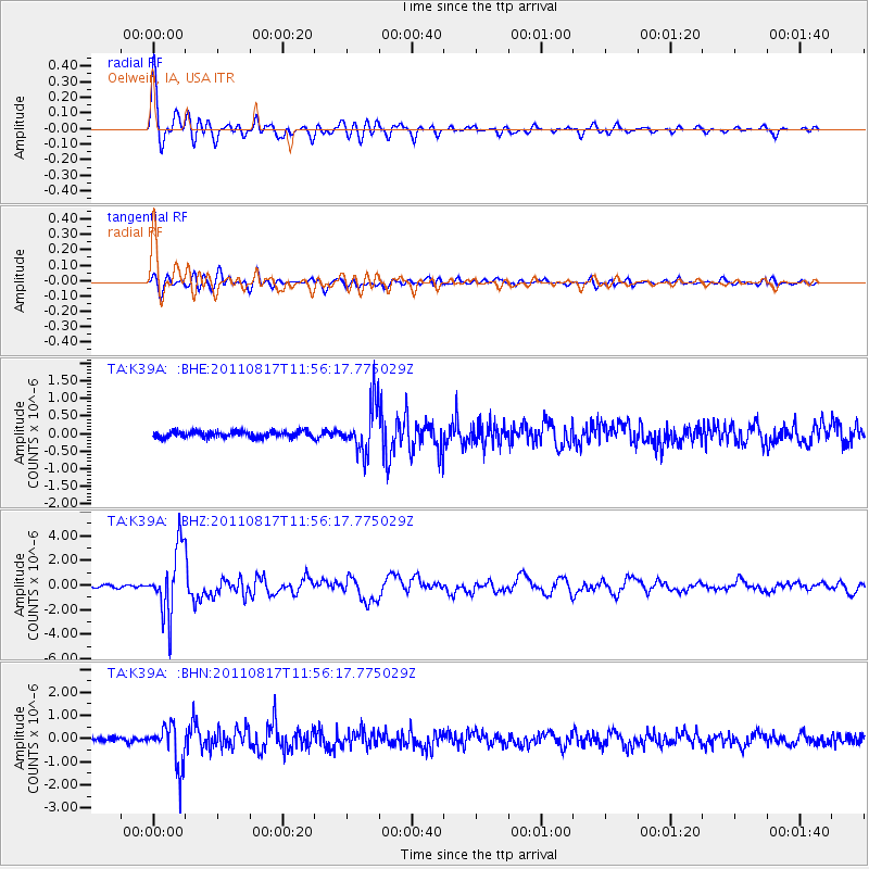
Signal To Noise
| Channel | StoN | STA | LTA |
| TA:K39A: :BHZ:20110817T11:56:17.775029Z | 33.109367 | 2.694417E-6 | 8.13793E-8 |
| TA:K39A: :BHN:20110817T11:56:17.775029Z | 9.958495 | 9.032172E-7 | 9.0698165E-8 |
| TA:K39A: :BHE:20110817T11:56:17.775029Z | 7.600979 | 6.7644874E-7 | 8.899495E-8 |
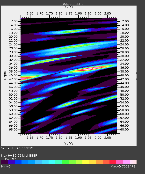
| Arrivals | |
| Ps | 5.5 SECOND |
| PpPs | 16 SECOND |
| PsPs/PpSs | 22 SECOND |

