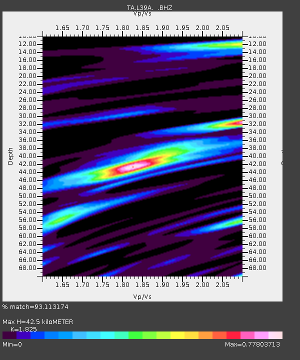
L39A Vinton, IA, USA - Earthquake Result Viewer
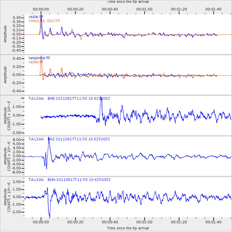
Earthquake location: Off East Coast Of Honshu, Japan
Earthquake latitude/longitude: 36.8/143.8
Earthquake time(UTC): 2011/08/17 (229) 11:44:08 GMT
Earthquake Depth: 9.0 km
Earthquake Magnitude: 6.1 MB, 5.8 MS, 6.2 MW, 6.1 MW
Earthquake Catalog/Contributor: WHDF/NEIC
Network: TA USArray Transportable Network (new EarthScope stations)
Station: L39A Vinton, IA, USA
Lat/Lon: 42.12 N/92.00 W
Elevation: 261 m
Distance: 86.4 deg
Az: 38.045 deg
Baz: 318.301 deg
Ray Param: 0.044056874
Estimated Moho Depth: 42.5 km
Estimated Crust Vp/Vs: 1.83
Assumed Crust Vp: 6.53 km/s
Estimated Crust Vs: 3.578 km/s
Estimated Crust Poisson's Ratio: 0.29
Radial Match: 93.113174 %
Radial Bump: 400
Transverse Match: 89.693726 %
Transverse Bump: 400
SOD ConfigId: 410809
Insert Time: 2012-01-06 07:23:14.322 +0000
GWidth: 2.5
Max Bumps: 400
Tol: 0.001

Signal To Noise

ChannelStoNSTALTA
TA:L39A: :BHZ:20110817T11:56:19.625005Z45.189643.3535878E-67.421143E-8
TA:L39A: :BHN:20110817T11:56:19.625005Z10.7587927.890447E-77.333952E-8
TA:L39A: :BHE:20110817T11:56:19.625005Z8.2187926.7890943E-78.260452E-8
Arrivals
Ps5.5 SECOND
PpPs18 SECOND
PsPs/PpSs23 SECOND