
P42A Winchester, IL, USA - Earthquake Result Viewer
| ||||||||||||||||||
| ||||||||||||||||||
| ||||||||||||||||||
|
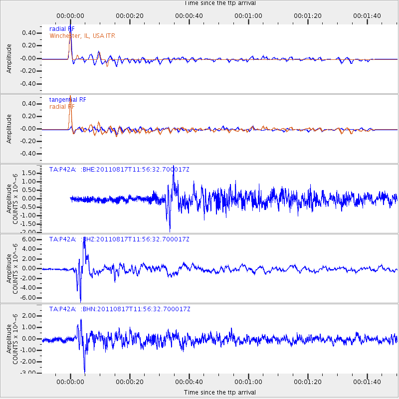
Signal To Noise
| Channel | StoN | STA | LTA |
| TA:P42A: :BHZ:20110817T11:56:32.700017Z | 45.32073 | 2.6234306E-6 | 5.7885888E-8 |
| TA:P42A: :BHN:20110817T11:56:32.700017Z | 9.622467 | 8.9182794E-7 | 9.2681844E-8 |
| TA:P42A: :BHE:20110817T11:56:32.700017Z | 6.935827 | 7.062201E-7 | 1.01822046E-7 |
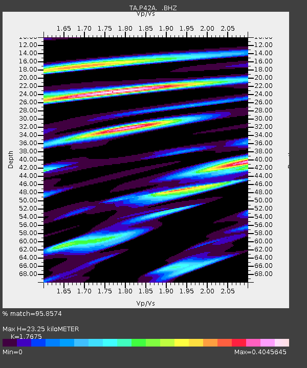
| Arrivals | |
| Ps | 2.8 SECOND |
| PpPs | 9.7 SECOND |
| PsPs/PpSs | 12 SECOND |

