M42A Sheffield, IL, USA - Earthquake Result Viewer
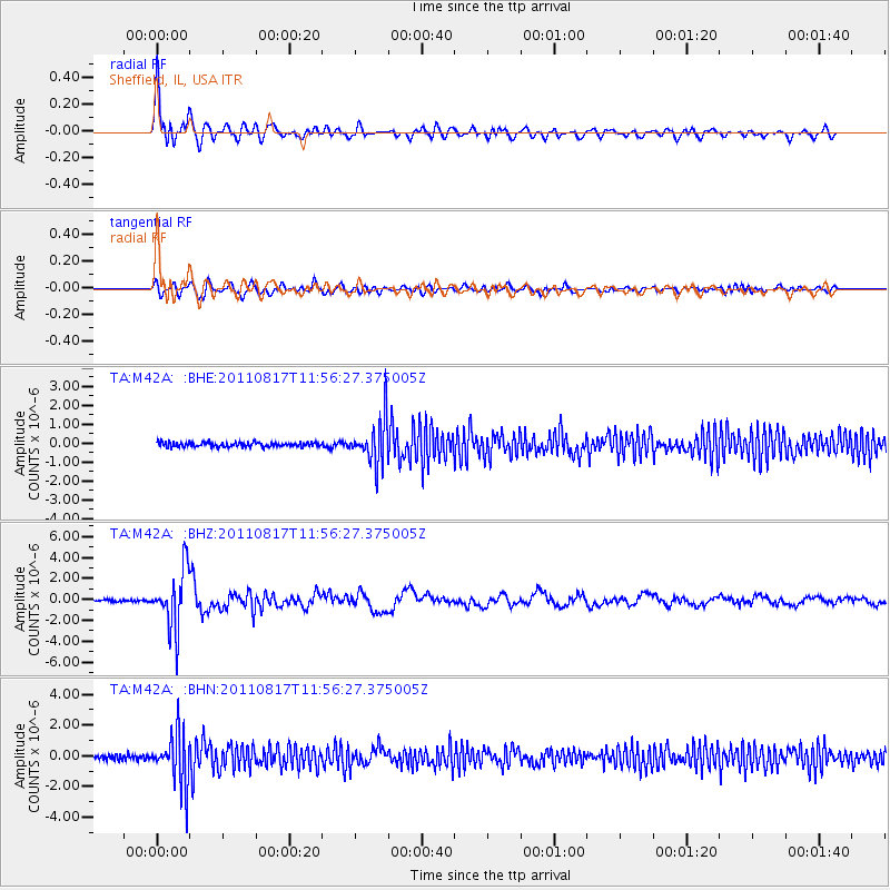
Earthquake location: Off East Coast Of Honshu, Japan
Earthquake latitude/longitude: 36.8/143.8
Earthquake time(UTC): 2011/08/17 (229) 11:44:08 GMT
Earthquake Depth: 9.0 km
Earthquake Magnitude: 6.1 MB, 5.8 MS, 6.2 MW, 6.1 MW
Earthquake Catalog/Contributor: WHDF/NEIC
Network: TA USArray Transportable Network (new EarthScope stations)
Station: M42A Sheffield, IL, USA
Lat/Lon: 41.45 N/89.76 W
Elevation: 212 m
Distance: 88.0 deg
Az: 37.216 deg
Baz: 319.75 deg
Ray Param: 0.042885866
Estimated Moho Depth: 40.75 km
Estimated Crust Vp/Vs: 1.77
Assumed Crust Vp: 6.498 km/s
Estimated Crust Vs: 3.661 km/s
Estimated Crust Poisson's Ratio: 0.27
Radial Match: 91.01 %
Radial Bump: 400
Transverse Match: 78.296295 %
Transverse Bump: 400
SOD ConfigId: 410809
Insert Time: 2012-01-06 07:24:31.368 +0000
GWidth: 2.5
Max Bumps: 400
Tol: 0.001

Signal To Noise

ChannelStoNSTALTA
TA:M42A: :BHZ:20110817T11:56:27.375005Z31.6891372.790205E-68.8049255E-8
TA:M42A: :BHN:20110817T11:56:27.375005Z12.8839121.6762525E-61.3010431E-7
TA:M42A: :BHE:20110817T11:56:27.375005Z9.9794211.1722792E-61.1746966E-7
Arrivals
Ps5.0 SECOND
PpPs17 SECOND
PsPs/PpSs22 SECOND