U44A Portageville, MO, USA - Earthquake Result Viewer
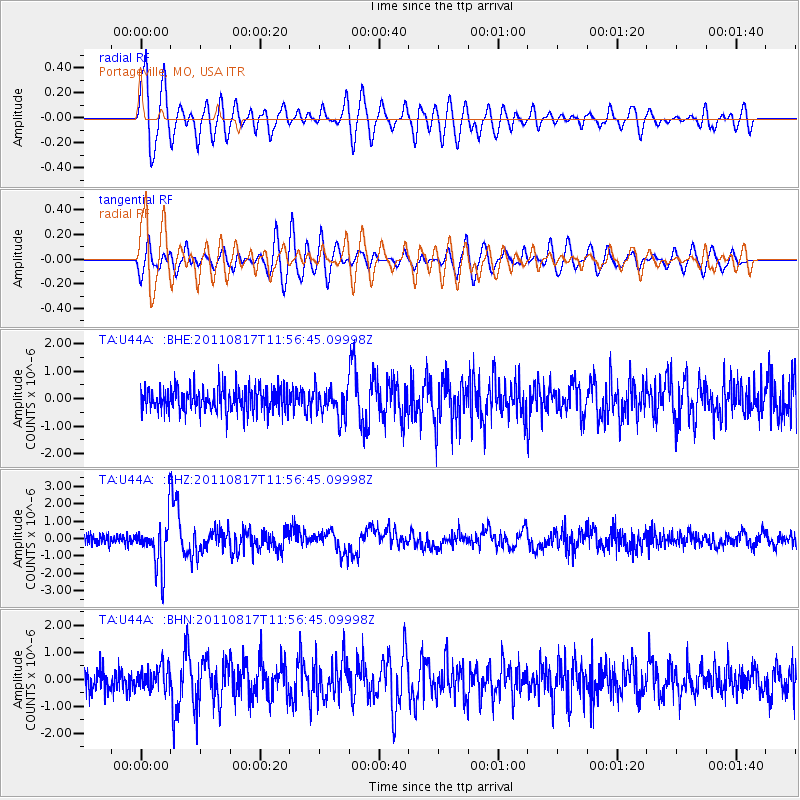
Earthquake location: Off East Coast Of Honshu, Japan
Earthquake latitude/longitude: 36.8/143.8
Earthquake time(UTC): 2011/08/17 (229) 11:44:08 GMT
Earthquake Depth: 9.0 km
Earthquake Magnitude: 6.1 MB, 5.8 MS, 6.2 MW, 6.1 MW
Earthquake Catalog/Contributor: WHDF/NEIC
Network: TA USArray Transportable Network (new EarthScope stations)
Station: U44A Portageville, MO, USA
Lat/Lon: 36.50 N/89.69 W
Elevation: 89 m
Distance: 91.8 deg
Az: 40.365 deg
Baz: 319.798 deg
Ray Param: 0.041547827
Estimated Moho Depth: 10.5 km
Estimated Crust Vp/Vs: 1.62
Assumed Crust Vp: 6.444 km/s
Estimated Crust Vs: 3.99 km/s
Estimated Crust Poisson's Ratio: 0.19
Radial Match: 80.810585 %
Radial Bump: 400
Transverse Match: 70.91541 %
Transverse Bump: 400
SOD ConfigId: 410809
Insert Time: 2012-01-06 07:25:17.284 +0000
GWidth: 2.5
Max Bumps: 400
Tol: 0.001

Signal To Noise

ChannelStoNSTALTA
TA:U44A: :BHZ:20110817T11:56:45.09998Z5.14261341.3455495E-62.6164702E-7
TA:U44A: :BHN:20110817T11:56:45.09998Z1.05880034.2043195E-73.9708334E-7
TA:U44A: :BHE:20110817T11:56:45.09998Z1.19244115.2702995E-74.4197571E-7
Arrivals
Ps1.0 SECOND
PpPs4.2 SECOND
PsPs/PpSs5.2 SECOND