H40A Chili, WI, USA - Earthquake Result Viewer
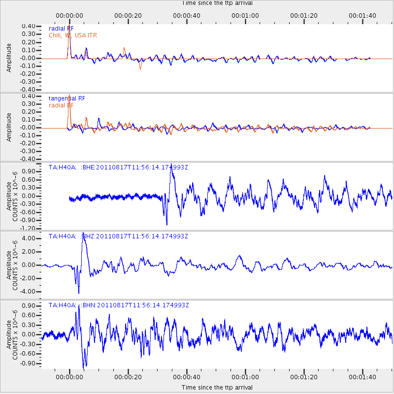
Earthquake location: Off East Coast Of Honshu, Japan
Earthquake latitude/longitude: 36.8/143.8
Earthquake time(UTC): 2011/08/17 (229) 11:44:08 GMT
Earthquake Depth: 9.0 km
Earthquake Magnitude: 6.1 MB, 5.8 MS, 6.2 MW, 6.1 MW
Earthquake Catalog/Contributor: WHDF/NEIC
Network: TA USArray Transportable Network (new EarthScope stations)
Station: H40A Chili, WI, USA
Lat/Lon: 44.62 N/90.39 W
Elevation: 372 m
Distance: 85.3 deg
Az: 35.509 deg
Baz: 319.221 deg
Ray Param: 0.044843975
Estimated Moho Depth: 42.75 km
Estimated Crust Vp/Vs: 1.88
Assumed Crust Vp: 6.571 km/s
Estimated Crust Vs: 3.5 km/s
Estimated Crust Poisson's Ratio: 0.30
Radial Match: 95.38803 %
Radial Bump: 400
Transverse Match: 90.62486 %
Transverse Bump: 400
SOD ConfigId: 410809
Insert Time: 2012-01-06 07:26:41.984 +0000
GWidth: 2.5
Max Bumps: 400
Tol: 0.001

Signal To Noise

ChannelStoNSTALTA
TA:H40A: :BHZ:20110817T11:56:14.174993Z28.1941811.9700576E-66.9874616E-8
TA:H40A: :BHN:20110817T11:56:14.174993Z6.46020754.0475848E-76.26541E-8
TA:H40A: :BHE:20110817T11:56:14.174993Z7.9437014.4195724E-75.563619E-8
Arrivals
Ps5.8 SECOND
PpPs18 SECOND
PsPs/PpSs24 SECOND