R43A Red Bud, IL, USA - Earthquake Result Viewer
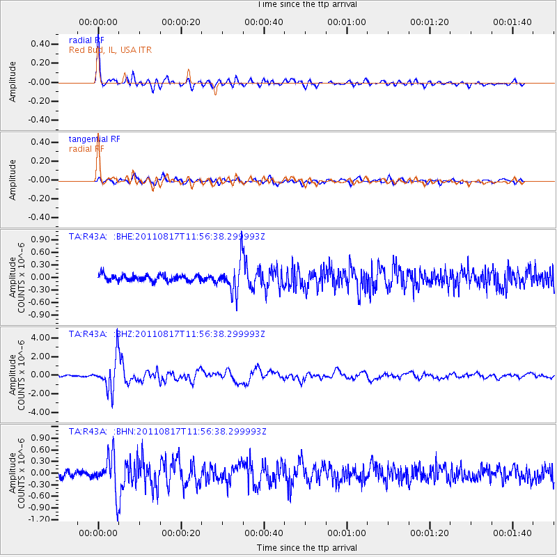
Earthquake location: Off East Coast Of Honshu, Japan
Earthquake latitude/longitude: 36.8/143.8
Earthquake time(UTC): 2011/08/17 (229) 11:44:08 GMT
Earthquake Depth: 9.0 km
Earthquake Magnitude: 6.1 MB, 5.8 MS, 6.2 MW, 6.1 MW
Earthquake Catalog/Contributor: WHDF/NEIC
Network: TA USArray Transportable Network (new EarthScope stations)
Station: R43A Red Bud, IL, USA
Lat/Lon: 38.28 N/89.93 W
Elevation: 186 m
Distance: 90.4 deg
Az: 39.37 deg
Baz: 319.669 deg
Ray Param: 0.041678123
Estimated Moho Depth: 60.75 km
Estimated Crust Vp/Vs: 1.89
Assumed Crust Vp: 6.444 km/s
Estimated Crust Vs: 3.409 km/s
Estimated Crust Poisson's Ratio: 0.31
Radial Match: 94.81178 %
Radial Bump: 400
Transverse Match: 80.12823 %
Transverse Bump: 400
SOD ConfigId: 410809
Insert Time: 2012-01-06 07:26:53.105 +0000
GWidth: 2.5
Max Bumps: 400
Tol: 0.001

Signal To Noise

ChannelStoNSTALTA
TA:R43A: :BHZ:20110817T11:56:38.299993Z32.393421.7626743E-65.4414578E-8
TA:R43A: :BHN:20110817T11:56:38.299993Z6.2483024.7944985E-77.6732825E-8
TA:R43A: :BHE:20110817T11:56:38.299993Z5.4360863.825969E-77.038095E-8
Arrivals
Ps8.6 SECOND
PpPs27 SECOND
PsPs/PpSs35 SECOND