I39A Houston, MN, USA - Earthquake Result Viewer
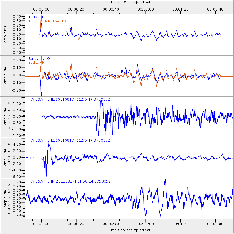
Earthquake location: Off East Coast Of Honshu, Japan
Earthquake latitude/longitude: 36.8/143.8
Earthquake time(UTC): 2011/08/17 (229) 11:44:08 GMT
Earthquake Depth: 9.0 km
Earthquake Magnitude: 6.1 MB, 5.8 MS, 6.2 MW, 6.1 MW
Earthquake Catalog/Contributor: WHDF/NEIC
Network: TA USArray Transportable Network (new EarthScope stations)
Station: I39A Houston, MN, USA
Lat/Lon: 43.85 N/91.52 W
Elevation: 393 m
Distance: 85.4 deg
Az: 36.631 deg
Baz: 318.524 deg
Ray Param: 0.044813294
Estimated Moho Depth: 35.0 km
Estimated Crust Vp/Vs: 1.81
Assumed Crust Vp: 6.53 km/s
Estimated Crust Vs: 3.603 km/s
Estimated Crust Poisson's Ratio: 0.28
Radial Match: 88.64886 %
Radial Bump: 400
Transverse Match: 89.85216 %
Transverse Bump: 400
SOD ConfigId: 410809
Insert Time: 2012-01-06 07:27:21.322 +0000
GWidth: 2.5
Max Bumps: 400
Tol: 0.001

Signal To Noise

ChannelStoNSTALTA
TA:I39A: :BHZ:20110817T11:56:14.375005Z37.9060482.5038678E-66.605457E-8
TA:I39A: :BHN:20110817T11:56:14.375005Z0.78637921.4764917E-71.8775823E-7
TA:I39A: :BHE:20110817T11:56:14.375005Z11.322176.364723E-75.6214688E-8
Arrivals
Ps4.5 SECOND
PpPs15 SECOND
PsPs/PpSs19 SECOND