
LEBA Lebam, WA, USA - Earthquake Result Viewer
| ||||||||||||||||||
| ||||||||||||||||||
| ||||||||||||||||||
|
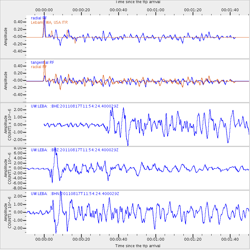
Signal To Noise
| Channel | StoN | STA | LTA |
| UW:LEBA: :BHZ:20110817T11:54:24.400029Z | 14.064089 | 1.7575504E-6 | 1.2496724E-7 |
| UW:LEBA: :BHN:20110817T11:54:24.400029Z | 5.0355144 | 4.8435135E-7 | 9.6187065E-8 |
| UW:LEBA: :BHE:20110817T11:54:24.400029Z | 2.9425526 | 4.1935456E-7 | 1.4251387E-7 |
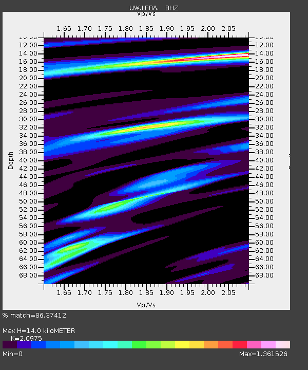
| Arrivals | |
| Ps | 2.4 SECOND |
| PpPs | 6.4 SECOND |
| PsPs/PpSs | 8.8 SECOND |

